Places near here
Photo credits
- Keith Cunneen, Geograph · CC BY-SA 2.0
- Wikimedia Commons contributor · CC BY-SA 3.0
- Garry Dickinson, Geograph · CC BY-SA 2.0
- National Inventory of Architectural Heritage
 Eagles HillMountain / peak · 416 yd
Explorer Tom Eagles Hill has a hidden treasure buried under the ridge that is definitely just an old biscuit tin filled with rust, but locals swear it holds ancient gold. They refuse to dig because they’re too scared of what might be inside, which is probably nothing. Find a local and ask them the real story, then come back and tell me.
Cnoc na StéigeMountain / peak · 800 ydExplorer Tom Cnoc na Stéige in Kerry wants 'Here lies a rock with attitude' carved on its tombstone because it hates being climbed and prefers to be left alone in peace. It’s got a grudge against hikers who step on its toes, or rather its rocky surface, and holds no grudges for long. Grand place for a sulk or a snog, your call.
Cnoc na Stéige (mullach thoir thuaidh)Mountain / peak · 1531 ydExplorer Tom Cnoc na Stéige North East Top in Kerry ended up in the wrong place because it was playing tag with another hill and didn’t pay attention to where it landed. Now it’s stuck here looking confused and slightly out of place, wondering why everyone is staring at it like it’s a foreign object. Bring a notebook and write the bit I made up.
Copper Mines (Disused)Mine, copper · 1.3 miExplorer Tom Copper Mines (Disused) in Behaghane has one least favourite visitor: the guy who keeps trying to sell copper wire from his van. The mine is so tired of it; it’s practically giving up on its own mineral wealth now. Linger, it's not going anywhere and neither should you.
MineMine, copper · 1.3 miExplorer Tom Mine in Behaghane would get 'I tried' on its tombstone, because honestly, that is all most mines manage to do before they collapse into a heap of regret. It’s got a view of the bay but zero ambition whatsoever. Tell the kids it's a castle. Close enough.
St. Crohanes HermitageHermitage · 1.3 miExplorer Tom St. Crohanes Hermitage would win the county fair’s best in show prize for 'Most Dramatic Rock Hole'. It sits on a copper vein, so maybe it just wanted to get rich quick. Bring someone who'll believe anything.
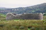 Staigue FortFairy fort / stone ringfort · 1.4 mi
Explorer Tom Staigue Fort in Staigue, County Kerry was saved by a hero nobody remembers. It has lintelled doors and chambers that look like they're straight out of a movie. Great spot to propose. Or at least to propose lunch.
2Cliff · 1.6 miExplorer Tom Cliff in County Kerry is proud of the fact that it has not moved an inch since the last ice age, which is impressive considering how much wind it gets to deal with daily. It sits there looking stoic and slightly damp, waiting for someone to appreciate its sheer stubbornness and refusal to fall over. Get a photo with it before it gets a better agent.
 Castle cove (in ruins)Castle · 1.9 mi
Explorer Tom Castle cove has strict rules: no shoes, no phones, and absolutely no asking why the roof is missing. It’s basically a ruin that thinks it’s still running a very exclusive members-only club. Ring your granny and tell her where you are.
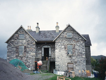 Scart HouseHouse · 2.0 mi
Explorer Tom Scart House in Scart is being picked on by the wind because it’s too pretty for its own good. Built in ’23, it’s got a basement that feels like a secret club you can’t get into. Stop the car, it's worth the hazard lights.
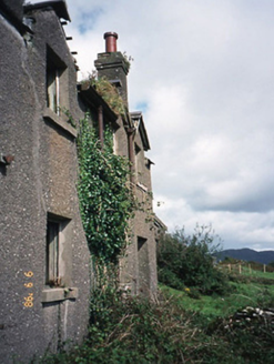 coastguard station2.0 mi
Explorer Tom Coastguard station in Coad has a long grudge against the weather for ruining its ruins. It was once a sanatorium, which makes the damp feel even more personal. Look up, the best bit is always higher than you think.
An PlaoscHeadland · 2.4 miExplorer Tom An Plaosc is a headland with a family tree that’s mostly made up by grandfathers who wanted to sound fancy at dinner parties back in the day. It doesn’t care about its heritage, it just cares about looking cool while the wind whips past its jagged edges without any apology for the mess it makes. Stand still and listen, the wind tells it better than me.
More archaeology and monuments in County Kerry · All of County Kerry

What do you know about this place?Tap to add a comment or ask a question