DDiscover AloneMapAbout

Toberavilla

Holy well
Computer-made picture that does not show ToberavillaNot a photo of this holy well
Computer-made picture. It does not show this holy well. · Report the wrong picture

The monument record does not grant public access. Check the route and ask the landowner before entering private land.

What do you know about this place?Tap to add a comment or ask a question

What you write will be public.

What is recorded here

Toberavilla/Tobar an Bhile: This spring well is located c. 30m WNW of Kilcrohane Medieval church and graveyard (KE106-032001-). It is covered by a low drystone structure, on top of which lies a cross-incised slab measuring 0.44m x 0.12m x 0.1m thick. An ash tree, marked 'Old Tree' on the first edition of the OS map,…

Read the whole record
Toberavilla/Tobar an Bhile: This spring well is located c. 30m WNW of Kilcrohane Medieval church and graveyard (KE106-032001-). It is covered by a low drystone structure, on top of which lies a cross-incised slab measuring 0.44m x 0.12m x 0.1m thick. An ash tree, marked 'Old Tree' on the first edition of the OS map, formerly stood beside the well and was locally reputed to mark the grave of St Crohane. A flat-topped boulder, referred to locally as a massrock, is located 27m E of the well. It measures 1.5m x 0.45m x 0.7m high, and beside it is a recumbent slate slab on which are a number of lightly incised crosses. The well and sacred tree or bile formed the principal assembly point of the three-day pattern formerly held in this parish in honour of St Crohane (OSL; Ó Cíobháin 1984a, 23-4). This is considered by MacNeill to have been originally a Lughnasa pilgrimage-assembly (1962, 648-50), and commenced on July 29th, Oíche Chrócháin. It included a turas or pilgrimage from Kilcrohane up to Windy Gap, close to the summit of Eagles Hill, where another holy well, Tobar na Bearnan (KE098-086----), is located. En route rounds were also made at Tobercrohane well (KE106-029002-). The pattern has been in decline from the mid-nineteenth century, and since the 1940s Toberavilla has rarely been visited. Folklore collected by James Brennan, a pupil of Derryleagh School recorded the following tradition; 'There is another holy well at Code called St. Crohane's well. People go to this well every year on the 29th of July. There is a rock near the well and there is a representation of St. Crohane's back on it because it is said he stretched near this rock once. There is also a tree there and it is around the tree the people make the rounds' (The Schools’ Collection, Volume 0467, Pages 257-8; https://www.duchas.ie/en/cbes/4742095/4735499). A second story collected from Sneem School recorded the following tradition; 'According to the old people St. Crohane is the patron saint of this place. The old Church ruins in Coad are dedictated to St. Crohane. The eastern stone has a slap of stone which is cut in the form of a cross. At the end of the ruin is a holy well shaded by a huge ash tree People pay rounds here on the thirtieth of July which is his feast day. Very long ago there was a man cured there. He was blind but nowadays there are no cures effected there there as it is more for pleasure people go there' (The Schools’ Collection, Volume 0468, Page 124; https://www.duchas.ie/en/cbes/4742098/4735715/4924360) See attached photographs of Toberavilla and Turas Chrócháin, Co. Kerry, taken 1946 by Caoimhín Ó Danachair courtesy of and © National Folklore Collection, UCD. The Photographic Collection, F025.18.00003 accessible online at https://www.duchas.ie/en/cbeg/16762 and F025.18.00005 accessible online at https://www.duchas.ie/en/cbeg/24632. Cork University Press (1996), no. 1054. Revised by: Caimin O'Brien Date of revised upload: 12 April 2022

From the National Monuments Service (Archaeological Survey of Ireland) record KE106-032003

Places near here

Picture notes
  • Computer-made picture. It does not show this monument.
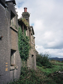
  • National Inventory of Architectural Heritage
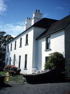
  • Garry Dickinson, Geograph · CC BY-SA 2.0
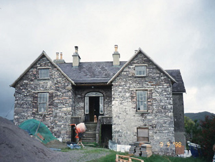
  • Keith Cunneen, Geograph · CC BY-SA 2.0
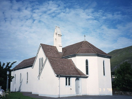
  • Phil Champion, Geograph · CC BY-SA 2.0
  • Computer-made picture. It does not show this playground.
Cross-slab in BehaghaneCross-slab · 1 ydComputer-made picture

Explorer Tom Cross-slab in Behaghane guards a spring well where there is definitely a hidden treasure, probably just an old biscuit tin. The slab is thin and fragile, so tread carefully if you want to see what’s underneath. Ideal spot for a dramatic phone call.

Cross-inscribed stone in BehaghaneCross-inscribed stone · 29 ydComputer-made picture

Explorer Tom Cross-inscribed stone in Behaghane sits on top of a well, complaining to the council that tourists keep dropping biscuits into the water. It’s only forty-four centimeters long, so it feels a bit small for all the drama surrounding it. Have a wander and a wonder.

Grave YardGraveyard · 82 ydComputer-made picture

Explorer Tom Graveyard in Behaghane holds the world record for the most dramatic view of Kenmare Bay while being completely ignored by hikers. It’s near Coad Mountain, which is basically a big rock with an attitude problem. Grand place for a sulk or a snog, your call.

Hut site in CoadHut site · 192 ydComputer-made picture

Explorer Tom Hut site in Coad is jealous of the rath next door because that one has better marketing. It’s just a semicircle of stones acting like it’s doing yoga. Great spot to propose. Or at least to propose lunch.

coastguard station1139 yd

Explorer Tom Coastguard station in Coad has a long grudge against the weather for ruining its ruins. It was once a sanatorium, which makes the damp feel even more personal. Look up, the best bit is always higher than you think.

Westcove HouseHouse · 1328 yd

Explorer Tom Westcove House in Coad had a first owner whose escape plan involved hiding in the garden until everyone left. It’s still suspicious of anyone walking too close to its L-plan walls, acting like it’s guarding a secret treasure. Get there early and have it all to yourself.

Castle Cove (in Ruins)Castle, tower house · 1.0 mi

Explorer Tom Castle Cove has caught my eye in Behaghane, County Kerry. I bet a castle, tower house with a name like that could keep me talking all afternoon; I'm already inventing a daft little scene for it, and I'll stop before it turns into history.

Reen BeachBeach / strand · 1.3 mi

Explorer Tom Reen Beach has caught my eye in County Kerry. I bet a beach / strand with a name like that could keep me talking all afternoon; I'm already inventing a daft little scene for it, and I'll stop before it turns into history.

Eagles HillMountain / peak · 1.4 mi

Explorer Tom Eagles Hill has caught my eye in County Kerry. I bet a mountain / peak with a name like that could keep me talking all afternoon; I'm already inventing a daft little scene for it, and I'll stop before it turns into history.

Cnoc na StéigeMountain / peak · 1.8 mi

Explorer Tom Cnoc na Stéige has caught my eye in County Kerry. I bet a mountain / peak with a name like that could keep me talking all afternoon; I'm already inventing a daft little scene for it, and I'll stop before it turns into history.

White StrandBeach / strand · 1.8 mi

Explorer Tom White Strand has caught my eye in County Kerry. I bet a beach / strand with a name like that could keep me talking all afternoon; I'm already inventing a daft little scene for it, and I'll stop before it turns into history.

Children's playground1.9 miComputer-made picture

Explorer Tom Children's playground has caught my eye in County Kerry. I bet a children's playground with a name like that could keep me talking all afternoon; I'm already inventing a daft little scene for it, and I'll stop before it turns into history.

More archaeology and monuments in County Kerry · All of County Kerry

Add to this placeAdd a picture Add a detailed tip Add a story

Explore the map1,093,392 places to discover

Next place · or swipeCross-slab in Behaghane