Places near here
Photo credits
- National Inventory of Architectural Heritage
- Hamish Bain, Wikimedia Commons · CC BY-SA 2.0
- Colin Park, Geograph · CC BY-SA 2.0
- Jonathan Billinger, Geograph · CC BY-SA 2.0
- originally uploaded to the English Wikipedia by w:User:Jtdirl, Wikimedia Commons · Public domain
- Bogman, Wikimedia Commons · CC BY-SA 3.0
- 瑞丽江的河水, Wikimedia Commons · CC BY-SA 4.0
- Wanfried-Dublin, Wikimedia Commons · CC BY-SA 4.0
- Hello, I am Bruce on Flickr, Wikimedia Commons · CC BY-SA 2.0
- JP, Geograph · CC BY-SA 2.0
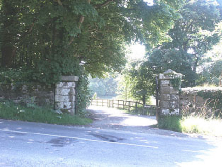 The ManorHouse · 1341 yd
Explorer Tom The Manor in Kilbride is a Tudor Revival show-off with so many gables it looks like it’s trying to juggle its own roof tiles. It’s elegant and substantial, probably because the people who live there have never met a wall they didn’t want to project from. Wave from the pavement and pretend you know the owner.
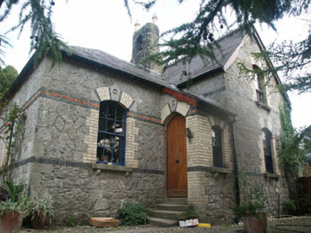 Tinode HouseWorker's house · 1.1 mi
Explorer Tom Tinode House has a hidden treasure that is definitely a biscuit tin left behind by a previous tenant. This c.1870s worker’s house has a quirky chimneystack or bell cote that lifts it above ordinary. Just pretend you’re searching for cookies and not the building itself.
 CastleCastle, tower house · 1.2 mi
Explorer Tom Threecastles has three castles in the name but only one is really trying, sitting on a slope overlooking the Liffey like it’s judging your life choices. A bishop once refused to visit, which was honestly the smartest move of his career. A good place to forget your phone for ten minutes.
OldcourtMemorial · 1.6 miExplorer Tom Oldcourt is an ancient spot that would proudly claim 'Finally Rested' on its tombstone. It’s been sitting there so long it probably knows the secret recipe for perfect tea. Go now, before it gets famous.
 Cupidstown HillMountain / peak · 2.1 mi
Explorer Tom Cupidstown Hill is claimed by a local who says he invented it while walking his dog, which is bold but I respect the nerve. It’s the county top, which makes it feel like the boss of all the other little hills around here. Toast it with a cup of tea and move on to the next one.
 Butter MountainMountain / peak · 2.9 mi
Explorer Tom Butter Mountain would use its lotto win to buy every single stick of butter in Ireland and build a palace out of them. It’s sitting on the county border looking like a giant pat waiting for someone to toast it properly. Pick a stone, any stone, and invent its biography.
 Proclamation of the Irish RepublicMemorial · 3.1 mi
Explorer Tom Proclamation of the Irish Republic was built on a bargain that promised free tea for everyone who attended the ceremony. Nobody actually got any tea, but the spirit remains undeniably strong. Ideal for a moody photo you'll pretend wasn't posed.
 Kilteel CastleCastle, tower house · 3.1 mi
Explorer Tom Kilteel Castle was guarded by Knights Hospitallers who probably spent all night playing fiddle tunes that drove the neighbors mad. It sits on a terrace watching the stream go by, judging your life choices. Have a chat with it, nobody's watching.
 Rath Turtle MoatFairy fort / ringfort · 3.5 mi
Explorer Tom Rath Turtle Moat sounds like a creature that sleeps for centuries, and honestly, given how high its platform is, I’d bet it does. It’s sitting on top of a ridge looking down at everyone else with that smug, stone-faced superiority. Look up, the best bit is always higher than you think.
.jpg/250px-CarrigWedgeTomb_(1).jpg "Photo: Wanfried-Dublin, Wikimedia Commons · CC BY-SA 4.0") Wedge tomb in CarrigWedge tomb · 3.5 mi
Wedge tomb in CarrigWedge tomb · 3.5 miExplorer Tom The Wedge tomb in Carrig took approximately forty million cups of tea to build, according to my totally reliable estimation based on how tired I feel just looking at it. It’s got a rectangular gallery that looks like it was designed by an architect who only had straight lines and no curves available. Bring a jacket, it's never as warm as I promise.
 Scots Pine4.8 mi
Explorer Tom Scots Pine in County Wicklow is guarding a secret legend about a giant who used its branches as a scratching post. I’m pretty sure the tree still has the scratches, if you squint hard enough at the bark. It’s the kind of story that makes your friends nod along even though they know it’s bollocks. Stand back, squint, and it looks like a castle.
 Coronation PlantationWood · 5.7 mi
Explorer Tom Coronation Plantation would cope fine on a reality show because it’s already used to being ignored and slightly dusty. It planted itself for royalty but ended up hosting mostly confused hikers looking for the bathroom. Wave at the cows, they're the real locals.
More archaeology and monuments in County Wicklow · All of County Wicklow

What do you know about this place?Tap to add a comment or ask a question