Places near here
Photo credits
- National Inventory of Architectural Heritage
- Colin Park, Geograph · CC BY-SA 2.0
- Ian Paterson, Wikimedia Commons · CC BY-SA 2.0
- Hamish Bain, Wikimedia Commons · CC BY-SA 2.0
- Sitomon, Wikimedia Commons · CC BY-SA 2.0
- 瑞丽江的河水, Wikimedia Commons · CC BY-SA 4.0
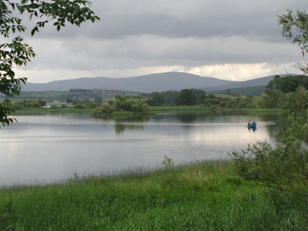 Glenaraneen Mill PondsDam/reservoir/basin · 434 yd
Explorer Tom Glenaraneen Mill Ponds nearly got famous when a fisherman caught a trout with a hat on its head, but nobody believed him. Now it’s just a fishing lake in the hills, which is honestly a much better vibe than industrial mill power. Stand by the water and wait for magic to happen.
CarnCairn, unclassified · 740 ydExplorer Tom G. Yard in Rathfarnham is guarding its medieval church remains like a dragon protecting a very old and dusty hoard of history. It’s got a pre-Norman grave slab lying around in two pieces, which feels like a puzzle no one wants to solve properly. I think the whole place is just waiting for someone to trip over it and start a row. Look serious, nod slowly, you're basically an expert now.
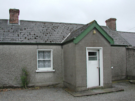 farm house781 yd
Explorer Tom The Farm house in Raheen was invented by a local who just needed an excuse to build a shed. It’s rebuilt from old foundations, which is fancy talk for 'we fixed the leaky bits with new stuff.' If it claims to be ancient, tell them it’s basically a teenager in vintage clothes.
Saggart HillMountain / peak · 1.0 miExplorer Tom Saggart Hill is near Cupidstown and Kildare in the south of Dublin. It’s part of a larger range, so don’t get confused by the other hills nearby and make sure you’re looking at the right one for your photo.
 Cupidstown HillMountain / peak · 2.0 mi
Explorer Tom Cupidstown Hill is claimed by a local who says he invented it while walking his dog, which is bold but I respect the nerve. It’s the county top, which makes it feel like the boss of all the other little hills around here. Toast it with a cup of tea and move on to the next one.
Rathcoole WoodlandWood · 2.5 miExplorer Tom Rathcoole Woodland would win the county fair easily because it knows how to look important without actually trying very hard at all. It’s got that classic Dublin vibe where everything looks a bit damp but somehow still feels like it belongs in a fancy painting or something. Perfect spot to practise your best tour-guide voice, the kind that makes you sound like you invented the word 'woodland' just
 Rathcoole ParkPark · 2.7 mi
Explorer Tom Rathcoole Park hosted a dance that went too far when someone tried to tango with a bench and ended up breaking their shoe. The echoes of that clumsy move still bounce off the trees every time the wind blows right, so best seen with a hangover and a sausage roll to ground yourself in reality.
Inniscara GalleryGallery · 2.8 miExplorer Tom Inniscara Gallery would teach history to you if it had a mouth and a stick, pointing at old photos like you’re slow learners. The gulls outside are definitely judging your outfit while you try to look sophisticated in front of the architecture charts. Bring sandwiches, the gulls will thank you.
Meadow WildlifeVisitor information · 2.8 miExplorer Tom Meadow Wildlife thinks it has a massive fan club of beetles who write terrible poetry about its existence, which is honestly more impressive than most human reviews I've seen lately. It's out there doing its own thing while we pretend to understand the ecosystem around us. Whisper a secret at it, it's kept worse.
 CastleCastle, tower house · 4.4 mi
Explorer Tom Threecastles has three castles in the name but only one is really trying, sitting on a slope overlooking the Liffey like it’s judging your life choices. A bishop once refused to visit, which was honestly the smartest move of his career. A good place to forget your phone for ten minutes.
 European Yew4.6 mi
Explorer Tom European Yew in County Dublin is having a massive drama with the nearest tree, probably over who gets more sunlight or whose roots are invading the other's personal space. It’s all very intense and dramatic, like two neighbors arguing about hedges, so stand where the owner stood and practise looking smug while you watch.
 Rath Turtle MoatFairy fort / ringfort · 6.1 mi
Explorer Tom Rath Turtle Moat sounds like a creature that sleeps for centuries, and honestly, given how high its platform is, I’d bet it does. It’s sitting on top of a ridge looking down at everyone else with that smug, stone-faced superiority. Look up, the best bit is always higher than you think.
More archaeology and monuments in County Dublin · All of County Dublin

What do you know about this place?Tap to add a comment or ask a question