Places near here
Photo credits
- Jonathan Thacker, Geograph · CC BY-SA 2.0
- National Inventory of Architectural Heritage
- kevin higgins, Wikimedia Commons · CC BY-SA 2.0
- Mike Searle, Geograph · CC BY-SA 2.0
- Mike Searle, Wikimedia Commons · CC BY-SA 2.0
- The Speckled Bird, Wikimedia Commons · CC BY-SA 4.0
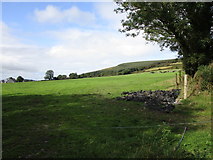
Explorer Tom Enclosure in Glen North was levelled years ago and now it’s just a memory on Mrs. Sexton’s land, which is a bit awkward for conversations. It used to be a square fort but now it’s basically a very flat rectangle of disappointment. Bring sandwiches, the gulls will thank you for not feeding them.
 Mount HillaryMountain / peak · 1371 ydMount Hillary - Mount Hillary LoopWalking route · 1.3 mi
 Lacka BrBridge · 1.3 mi
Explorer Tom Lacka Bridge in Glen South is showing off its three arches like it’s got a secret. It’s been straddling that river since the 1800s, probably judging your driving all while you do it. Give it a pat on the way past, it’s had a long life.
 Lacka BridgeBridge · 1.3 mi
Explorer Tom Lacka Bridge is doing some serious flexing with those triple arches over the Glen River. Built c. 1810, the cutwaters and voussoirs are just begging for a photo op. It’s a technical marvel that looks like it belongs in a museum.
 Mount Hillary - Father Murphy LoopWalking route · 1.5 mi
 St Abigails WellHoly well · 2.7 mi
Explorer Tom St Abigails Well is enclosed in a D-shaped structure with niches for cups, looking very organized and bureaucratic. It’s still in use and has crosses carved on the stones by pilgrims who needed to mark their spot. Stand there long enough and someone will ask if you're lost.
 Eagle's NestMountain / peak · 2.8 mi
 Castle Magner (in Ruins)Bawn · 4.8 mi
Explorer Tom Castle Magner Bawn in Castlemagner, County Cork was forfeited by the Magners and then given back to them, which sounds like a very confusing game of tag. Now it’s just a farmyard with some historical vibes. Try not to let the Bretridges steal your story while you’re there!
 Lohort CastleCastle, tower house · 5.0 mi
Explorer Tom Lohort Castle in Castlelohort Demesne, County Cork was burnt down in 1922 but now it’s a private residence with a stepped gable. It’s five storeys high and looks very pleased with itself. Knock on the door if you want to see if anyone is home!
 Dromaneen CastleHeritage attraction · 5.1 mi
 Kanturk CastleHeritage attraction · 5.3 mi
More historic places in County Cork · All of County Cork

What do you know about this place?Tap to add a comment or ask a question