What is recorded here
Situated on W facing slope of a ridge of high ground running N-S. Large irregular shaped graveyard which appears to have recently been cleaned up. This resulted in all the large recumbent headstones being removed from their original position and erected against the enclosing graveyard wall. Most of these sandstone slabs are of 18th-century date. There is a limestone table-tomb (OF039-036002-) dating to 1648 which belongs to the Darby family with their coat of arms on top. This grave is located at the W end of the S wall of the 19th-century parish church which is located in the N sector of the graveyard. 19th century C of I church may have been built on the site of a medieval church (OF039-036001-). (Cooke 1875, 220)
The above description is derived from the published 'Archaeological Inventory of County Offaly' (Dublin: Stationery Office, 1997).
Situated on W facing slope of a ridge of high ground running N-S. Large irregular shaped graveyard which appears to have recently been cleaned up. This resulted in all the large recumbent headstones being removed from their original position and erected against the enclosing graveyard wall. Most of these sandstone slabs are of 18th-century date. There is a limestone table-tomb (OF039-036002-) dating to 1648 which…
From the National Monuments Service (Archaeological Survey of Ireland) record OF039-036
The monument record does not grant public access. Check the route and ask the landowner before entering private land.
- What survives
- Recorded monument
Places near here
Photo credits
- National Inventory of Architectural Heritage
- Mike Searle, Wikimedia Commons · CC BY-SA 2.0
- D. Brands, Wikimedia Commons · CC BY-SA 3.0
- Didier Descouens, Wikimedia Commons · CC BY-SA 4.0
- Andreas F. Borchert, Wikimedia Commons · CC BY-SA 4.0
- Jonathan Thacker, Geograph · CC BY-SA 2.0
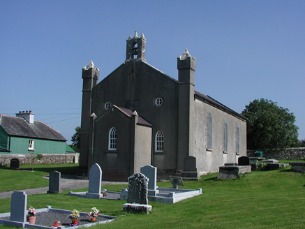 Aghancon ChurchChurch/chapel · 14 ydCrannog in BallycurraghCrannog · 213 yd
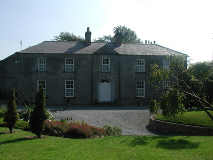 The RectoryRectory/glebe/vicarage/curate's house · 404 yd
.jpg/250px-Castles_of_Leinster-_Leap,_Offaly_(geograph_1952754).jpg "Photo: Mike Searle, Wikimedia Commons · CC BY-SA 2.0") Leap CastleCastle/fortified house · 1586 yd
Leap CastleCastle/fortified house · 1586 yd Leap CastleCastle · 1587 ydCastleCastle, tower house · 1606 ydGlenacurragh CastleCastle, tower house · 1.5 mi
 Hawthorn2.2 mi
 St. Kierans Bush & StoneRitual site, holy tree/bush · 2.2 miDrummin HillMountain / peak · 2.2 miHawthorn2.5 mi
 River WalkWalking route · 6.3 mi
More archaeology and monuments in County Offaly · All of County Offaly
What do you know about this place?