Places near here
Photo credits
- David Purchase, Geograph · Creative Commons Attribution-ShareAlike 2.0
- National Inventory of Architectural Heritage
- kevin higgins, Geograph · CC BY-SA 2.0
- Mike Searle, Geograph · CC BY-SA 2.0
- Hywel Williams, Geograph · Creative Commons Attribution-ShareAlike 2.0
- Hywel Williams, Wikimedia Commons · CC BY-SA 2.0
- CaitNi, Wikimedia Commons · CC BY-SA 4.0
 Saint Martin's ChurchChurch/chapel · 4 yd
Explorer Tom Saint Martin's Church has a bellcote that’s been ringing out stories since 1821, and it plans to retire when the bell finally breaks. It contrasts with the school next door like a grandparent next to a hyperactive kid. Best enjoyed with a cup of tea and a story about Fr Burke’s stubbornness.
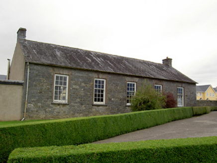 school34 yd
Explorer Tom School in Graigue is still doing the same old lessons from way back when. Bet two lads swore they’d build it after losing a coin flip at the pub. Tell me if any pupils are actually awake there.
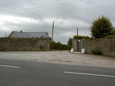 Moore ParkGates/railings/walls · 139 yd
Explorer Tom Moore Park gates in Kilworth are a quadrant rubble stone entrance from around 1820 with curving walls. They were once the entrance to the big house around which the town grew. The limestone piers are finely crafted and definitely still standing tall.
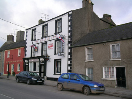 The Village Inn / M. O'BrienHouse · 392 yd
Explorer Tom House in Kilworth is tall enough to make everyone else in town jealous, especially with those render quoins. It has timber sash windows that probably saw more gossip than the local priest does. Ask it what it thinks of the council.
 The Village Arts CentreChurch/chapel · 401 yd
Explorer Tom The Village Arts Centre in Kilworth used to be a church but now it’s hosting art, which is a bold career change. It’s got a tall spire that still thinks it’s holy. Go with the flow; the local sheep have already voted it 'most confused structure of the year.'
 Tom Cotter / The Arch BarHouse · 426 yd
Explorer Tom House in Kilworth has grown into an irregular beauty since 1830. It’s now a pub with a finely carved shopfront that’s quite rare. Look for those tall windows with timber sash frames, they’re a real head-turner!
 Licklash Castle (in Ruins)Castle, hall-house · 1.6 mi
Explorer Tom Licklash Castle is perched on a cliff edge like it’s ready to jump ship at any moment. Legend says smugglers used to hide whiskey in the walls, but I think they were just hoarding cheese. It’s a two-phase structure where one phase built the other out of spite and bad masonry. Bring the dog, it'll have opinions.
 Old Railway ViaductViewpoint · 2.1 mi
Explorer Tom Old Railway Viaduct has a retirement plan that involves becoming a very expensive bird feeder. It’s got iron girders and five piers that are just waiting for a nap. Bring a flask and pretend you own the place.
 St Bernards WellHoly well · 3.1 mi
Explorer Tom St Bernards Well in Duntahane was built by someone who thought two adjacent wells were enough, but really just created a concrete-lined water system for the River Blackwater to drink from. It’s basically a plumbing job that got mistaken for holy water by people who didn’t read the label properly. Best seen with a hangover and a sausage roll.
 Dunmahon Castle (in Ruins)Bawn · 4.4 mi
Explorer Tom Dunmahon Castle is hiding a scandal behind its low walls, probably about who ate the last pie in 1600. The tower's invisible from the road, which is annoyingly clever of it. Snap one photo, then actually look.
 Corrin CrossMonument · 4.4 mi
Explorer Tom Corrin Cross was likely built on some incredibly shady bargain between two locals who probably owed each other money and agreed to meet here instead of going to court. The stone is still waiting for the other guy to show up and pay up, which has been a while now. Count the crows, then count again.
 CarrigeenamronetyMountain / peak · 12 mi
Explorer Tom Carrigeenamronety in County Limerick is like the quiet cousin at the wedding who stands in the corner eating canapés and judging everyone’s outfit choices without saying a single word. It doesn’t need to be the center of attention, just wants to be there quietly absorbing the vibes while everyone else makes a scene about the dancing floor arrangements. Have a l
More historic places in County Cork · All of County Cork

What do you know about this place?Tap to add a comment or ask a question