Places near here
Photo credits
- Mike Searle, Geograph · CC BY-SA 2.0
- National Inventory of Architectural Heritage
- Mike Searle, Geograph · Creative Commons Attribution-ShareAlike 2.0
- Malene Thyssen, Wikimedia Commons · CC BY-SA 3.0
- A.-K. D., Wikimedia Commons · CC BY-SA 4.0
- Sitomon, Wikimedia Commons · CC BY-SA 2.0
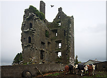 Castle (in Ruins)Castle, tower house · 1196 yd
Explorer Tom Castle in Garranmaconly is gone, but the matchmaker who worked there still sends letters to no one. Four storeys of history now just sit politely on a rock. Bring wellies and low expectations, leave delighted.
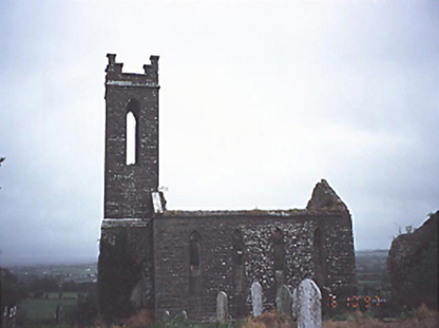 Skirk ChurchChurch/chapel · 1.0 mi
Explorer Tom Skirk Church in County Laois is a Board of First Fruits ruin that still thinks it’s running the whole parish. There’s an older church ghost lurking south of it, probably judging the new build’s two-stage tower for trying so hard. Go in good boots and better humour.
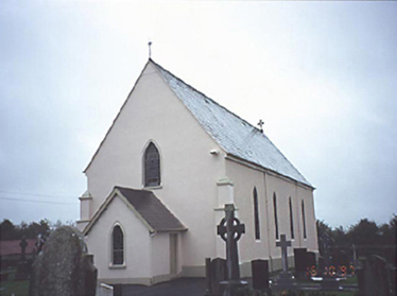 Catholic Church of the AssumptionChurch/chapel · 1.2 mi
Explorer Tom This church in Killadooley has a ghost that’s too lazy to haunt the gallery properly. It just naps in the back row instead of scaring anyone. Bring a notebook and write the bit I made up.
 Saint Patrick's Catholic ChurchChurch/chapel · 1.6 mi
Explorer Tom Saint Patrick's Catholic Church in Rockforest was once ruled by a goat named Bessie who ate all the altar flowers and declared herself bishop; the limestone blocks still bear the marks. It’s simple and small, which is perfect for a rural site where nobody wants to deal with a full-blown cathedral. If you see a hoofprint on the sandstone, don’t panic; it’s just Bessie’s ghost checking in for Mass.
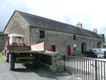 Rockforest HouseBuilding misc · 2.1 mi
Explorer Tom Rockforest House in Rockforest has given up its main building but kept a silly tower that looks like a hat. I reckon it gave up chocolate for Lent and replaced it with stone brackets instead. Have a careful look at the corner where the road bends; it might wink at you.
 Tinderry HouseHouse · 2.1 mi
Explorer Tom Tinderry House has windows everywhere except where you’d expect them, making it look like it’s mid-argument with itself. It’s hiding a scandal about that chamfered corner that nobody wants to talk about. Keep your distance; the wet dash walls are judging you already.
Black HillMountain / peak · 3.3 miExplorer Tom Black Hill in County Tipperary was once tried to be bought by a cow who thought it had very good grazing potential. The deal fell through because the cow kept trying to eat the contract documents. It's the kind of place that makes a dull Tuesday interesting.
 Derrin Castle (in ruins)Castle · 3.9 mi
Explorer Tom Derrin Castle would have 'I Tried My Best' written on its tombstone if it could choose its own epitaph and font style. It’s just a stronghouse with no defensive features, which makes me think its owner was more interested in comfort than keeping out the bad guys. Bring a flask and pretend you own the place.
 European Beech4.5 mi
Explorer Tom European Beech in County Tipperary was nearly sold off as a horse once, which is a bit of a stretch for anyone who has seen the thing. It just stands there looking dignified, like it knows exactly how ridiculous that story actually is. Stop the car, it's worth the hazard lights.
 CrossCross, High cross · 4.5 mi
Explorer Tom Cross in Monaincha started because two lads made a bet in the pub about who could carve better horses. One of them probably still owes the other a pint for losing. Look for the ghost, then pretend you didn't.
 European Yew5.1 mi
Explorer Tom European Yew in County Tipperary took about forty cups of tea to build its current level of smugness, and it shows every single time you look at it. It has the perfect amount of attitude to make you feel small without trying too hard. Bring biscuits, every good story needs biscuits.
.jpg/250px-Aghmacart_graveyard_from_above_(1).jpg "Photo: A.-K. D., Wikimedia Commons · CC BY-SA 4.0") Grave YardGraveyard · 8.7 mi
Grave YardGraveyard · 8.7 miExplorer Tom Graveyard in Aghmacart has an imaginary fan club that meets every Tuesday night under the moonlight. The church is on one side and the priory on the other, like a sandwich. Look up, the best bit is always higher than you think.
More archaeology and monuments in County Laois · All of County Laois

What do you know about this place?Tap to add a comment or ask a question