
Places near here
Photo credits
- National Inventory of Architectural Heritage
- User Coil00 on en.wikipedia, Wikimedia Commons · CC BY-SA 3.0
- Adrian King, Geograph · CC BY-SA 2.0
Explorer Tom Fairy fort / earthen ringfort in Garraneycarney is playing hard to get, hiding under conifers like a shy elf. It’s just…
 sign post1.5 mi
Explorer Tom Sign post in Carriganimmy is a 1940s time capsule with embossed letters that look like they were carved in stone. It’s…
 St John the Baptist Roman Catholic ChurchChurch/chapel · 1.6 mi
Explorer Tom St John the Baptist Church in Carriganimmy is modest but has stained glass that’ll blow your mind. It’s been renovated…
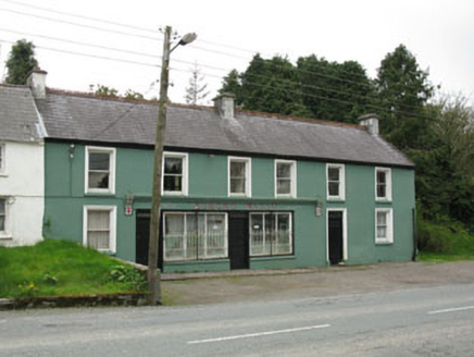 Edmond WalshHouse · 1.7 mi
Explorer Tom Edmond Walsh in Carriganimmy hosted a dance where someone stepped on the floor and it broke, so now it’s both a shop…
Mullaghanish Far North-East TopMountain / peak · 1.7 miExplorer Tom Mullaghanish Far North-East Top has a shortcut that is definitely not a shortcut, just a muddy detour through bog. I’d…
Cnoc na nUlán (mullach thoir)Mountain / peak · 1.8 miExplorer Tom The eastern top of Cnoc na nUlán inspired a bad poem by some guy who lost his keys and blamed the wind for it. The…
 Glantane EastArchaeological place · 1.9 mi
Explorer Tom Glantane East in County Cork has a favourite song that only the wind can hear properly. It's been singing the same tune…
CastleCastle, unclassified · 6.0 miExplorer Tom Castle in Cúil An Mhothair makes the wild claim that it is older than the hills surrounding it, scattered with loose…
European long distance path E8 - part IrelandWalking route · 6.4 miExplorer Tom European long distance path E8 - part Ireland in County Cork is dreaming about winning the lottery and buying a private…
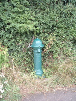 water pump9.6 mi
Explorer Tom Water pump in Mullaghroe North has been standing there since the 1880s, looking very Victorian about it. It’s a…
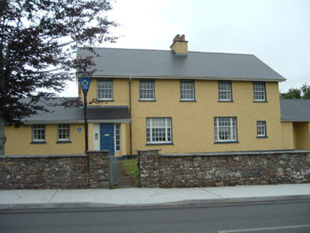 Knocknagree Garda StationGarda station/constabulary barracks · 11 mi
Explorer Tom 17. Knocknagree Garda Station looks like a fancy country house because it was built in the Domestic Revival style…
 Knocknagree Roman Catholic ChurchChurch/chapel · 11 mi
Explorer Tom Knocknagree Roman Catholic Church is having a quiet rivalry with every other church in town. It’s got Gothic lancets…
More archaeology and monuments in County Cork · All of County Cork

What do you know about this place?Tap to add a comment or ask a question