
What is recorded here
Situated at the S end of a small N-S ridge, on the E-facing slope. It is in a loop of the SW-NE Blackwater River that curves around it from SW (c. 70m distant)-E-NE (c. 140m distant). This southern end of the townland probably was an island at one time with the river taking the direct route NW of the monument. A large…
Read the whole record
From the National Monuments Service (Archaeological Survey of Ireland) record MO009-026
Places near here
Picture notes
- Computer-made picture. It does not show this monument.
- National Inventory of Architectural Heritage
- Andreas F. Borchert, Wikimedia Commons · CC BY-SA 3.0 de
- Computer-made picture. It does not show this playground.
- Raymond Okonski, Wikimedia Commons · CC BY-SA 2.0
- Willow, Wikimedia Commons · CC BY 2.5
 Fairy fort / earthen ringfort in Eden IslandFairy fort / earthen ringfort · 112 ydComputer-made picture
Explorer Tom Fairy fort / earthen ringfort in Eden Island got lost when the Vikings were looking for it, so they just settled nearby instead. The river curves around it like a protective arm, keeping the water at a safe distance. Give it a pat on the way past, it's had a long life.
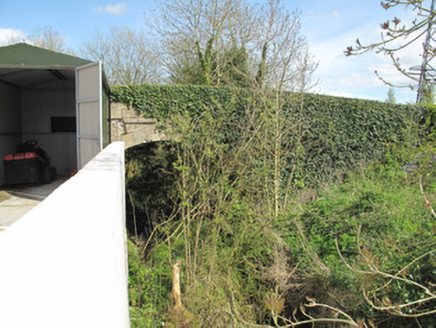 bridge287 yd
Explorer Tom Bridge in Knockaconny has a ridiculous smuggling story where men hid whiskey under the lock keeper’s bed. The Ulster Canal is long gone, but this bridge still stands guard over the empty waterway. Pretend you're a lost aristocrat and strike a pose.
 Fairy fort / earthen ringfort in DrumrutaghFairy fort / earthen ringfort · 448 ydComputer-made picture
Explorer Tom Fairy fort / earthen ringfort in Drumrutagh thinks the road leading to it is a personal insult against its dignity. It’s invisible from the ground, which is a bit cheeky for a monument. Make a wish, it's had centuries of practice.
 Bessmount ParkGate lodge · 517 yd
 Fairy fort / earthen ringfort in Crumlin (monaghan By., Tehallan Par.)Fairy fort / earthen ringfort · 529 ydComputer-made picture
 Lisnanore FortDesigned landscape, tree-ring · 854 ydComputer-made picture
Explorer Tom Lisnanore Fort is a tree-ring pretending to be a fortress with a secret tunnel to the pub. It’s basically just a very circular garden party that got lost. Go on, count the windows and get it wrong like I did.
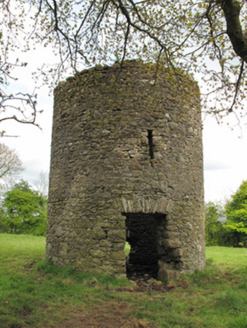 mill (wind)855 yd
Explorer Tom Mill in Lisnanore had a prophecy saying it would fly to Paris next year. It’s still sitting there looking confused and slightly dusty about the whole thing. Stand still and let the wind whisper secrets.
 Saint Macartan's CollegeConvent/nunnery · 1000 yd
Explorer Tom Saint Macartan's College nearly ended up as a horse stable, but the nuns out-negotiated the farmer. The stone doorcase looks expensive because it is, and the windows still judge you for your fashion choices. Have a wander and whisper to the bricks.
 Monaghan County MuseumMuseum · 1.5 mi
 Children's playground1.5 miComputer-made picture
 Rossmore MonumentMemorial · 1.7 mi
 European ash1.9 mi
More archaeology and monuments in County Monaghan · All of County Monaghan

What do you know about this place?Tap to add a comment or ask a question