What is recorded here
Located at the crest of the N-facing slope of a NNE-SSW drumlin ridge and c. 100m SW of Dungillick House. A complete circular enclosure defined by a field bank is depicted on the 1834 edition of the OS 6-inch map and a portion of an enclosure is shown on the 1907 edition. It is known locally as a fort and portion of the bank is preserved in a field bank SW-W-N (Chord 31m).
From the National Monuments Service (Archaeological Survey of Ireland) record MO003-043
Places near here
Photo credits
- National Inventory of Architectural Heritage
- Kenneth Allen, Wikimedia Commons · CC BY-SA 2.0
- Wsiegmund, Wikimedia Commons · CC BY 2.5
- Vyacheslav Argenberg from Seattle, WA, USA, Wikimedia Commons · CC BY 2.0
- Kenneth Allen, Geograph · CC BY-SA 2.0
- Andreas F. Borchert, Wikimedia Commons · CC BY-SA 3.0 de
- Raymond Okonski, Wikimedia Commons · CC BY-SA 2.0
- Brian Lenehan, Geograph · CC BY-SA 2.0
- Colin Park, Geograph · CC BY-SA 2.0
- James O'Neill, Wikimedia Commons · CC BY-SA 4.0
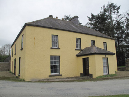 Dungillick HouseHouse · 151 yd
Explorer Tom Dungillick House would survive a zombie attack by locking its sliding sash windows and waiting for them to give up. The stone doorway looks sharp enough to cut bread with. Give it a pat on the head, it’s shy.
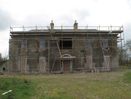 Fort SingletonHouse · 1647 yd
 Emy LoughPark · 1.7 mi
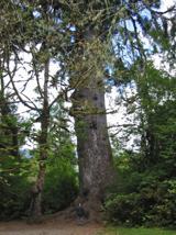 Sitka Spruce3.9 mi
 Caucasian Fir3.9 mi
 Sliabh Beagh WayWalking route · 5.0 mi
 Monaghan County MuseumMuseum · 6.6 mi
 Sliabh Beagh Hotel and Tourism CentreVisitor information · 6.8 mi
 Rossmore MonumentMemorial · 6.9 mi
 Old Cross SquareMonument · 7.0 mi
 Slieve Beagh se TopMountain / peak · 8.3 mi
 Battle site: battle of benburb in DeerycreevyBattle Site: Battle of Benburb · 9.6 mi
More archaeology and monuments in County Monaghan · All of County Monaghan

What do you know about this place?Tap to add a comment or ask a question