What is recorded here
A circular hachured feature indicated on the 1st ed. 'OS 6-inch' map (diam. c. 40m). It is not indicated on the revised 1908 'OS 6-inch' map. When inspected by ASI in 1990, nothing of archaeological significance was noted.
From the National Monuments Service (Archaeological Survey of Ireland) record WI031-024
The monument record does not grant public access. Check the route and ask the landowner before entering private land.
- What survives
- Recorded monument
Places near here
Photo credits
- Sitomon, Wikimedia Commons · CC BY-SA 2.0
- National Inventory of Architectural Heritage
- Willow, Wikimedia Commons · CC BY 2.5
- David Sands, Geograph · CC BY-SA 2.0
- Andreas F. Borchert, Wikimedia Commons · CC BY-SA 4.0
- Sarah777 at English Wikipedia, Wikimedia Commons · Public domain
 European Yew392 yd
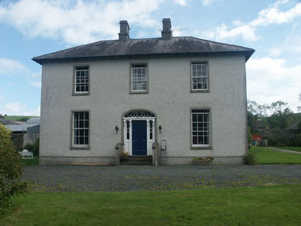 Dunganstown HouseCountry house · 419 yd
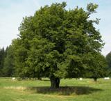 European hornbeam420 ydEnclosure in Dunganstown WestEnclosure · 476 ydEnclosure in Dunganstown WestEnclosure · 614 yd
 Springfield HouseHouse · 1493 ydFurzeditch BeachBeach / strand · 2.4 mi
 Brittas BayBeach / strand · 2.7 miGlen Beach Cliff WalkWalking route · 4.9 miRound MountCastle, motte · 5.0 mi
 Black Castle (in ruin)Castle, Anglo-Norman masonry castle · 5.1 mi
 Carrick MountainMountain / peak · 5.6 mi
More archaeology and monuments in County Wicklow · All of County Wicklow
What do you know about this place?