What is recorded here
Situated on high ground overlooking the Leitrim River at the N end of Wicklow town. A steep-sided mound (H 6-7m) which has been dug into at the SE and is very overgrown with trees and briars. It was probably part of the medieval borough of Wicklow (WI025-012----). (Price 1936, 41)
The above description is derived from the published 'Archaeological Inventory of County Wicklow' (Dublin: Stationery Office, 1997). 114/1940).
From the National Monuments Service (Archaeological Survey of Ireland) record WI025-012001
The monument record does not grant public access. Check the route and ask the landowner before entering private land.
- What survives
- Recorded monument
Places near here
Photo credits
- Jonjobaker, Wikimedia Commons · CC BY-SA 4.0
- National Inventory of Architectural Heritage
- Andreas F. Borchert, Wikimedia Commons · CC BY-SA 4.0
- Maker named on the Wikimedia Commons picture page · CC BY-SA 2.5
- Sitomon, Wikimedia Commons · CC BY-SA 2.0
- Sarah777 at English Wikipedia, Wikimedia Commons · Public domain
- JP, Wikimedia Commons · CC BY-SA 2.0
- 瑞丽江的河水, Wikimedia Commons · CC BY-SA 4.0
- Yablochko, Wikimedia Commons · CC0
- Pierre Terre, Geograph · CC BY-SA 2.0
Font (present location) in Glebe (newcastle By., Wicklow Urban Ed) (detached Portion)Font (present location) · 93 yd Saint Livinius's Church (Rathnew)Church/chapel · 94 ydpost box110 ydBlack Castle (in ruin)Castle, Anglo-Norman masonry castle · 1167 ydSessile Oak2.4 miEuropean Yew2.5 miCarrick MountainMountain / peak · 5.0 miDevil's Glen WaterfallWaterfall · 5.9 miViewing TowerHeritage attraction · 8.9 miVictor's WayHeritage attraction · 10.0 miWhite HillMountain / peak · 12 miJ.b. Malone MemorialMemorial · 12 mi
 Saint Livinius's Church (Rathnew)Church/chapel · 94 yd
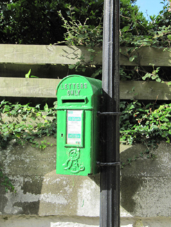 post box110 yd
 Black Castle (in ruin)Castle, Anglo-Norman masonry castle · 1167 yd
 Sessile Oak2.4 mi
 European Yew2.5 mi
 Carrick MountainMountain / peak · 5.0 mi
 Devil's Glen WaterfallWaterfall · 5.9 mi
 Viewing TowerHeritage attraction · 8.9 mi
 Victor's WayHeritage attraction · 10.0 mi
 White HillMountain / peak · 12 mi
 J.b. Malone MemorialMemorial · 12 mi
More castles and forts in County Wicklow · All of County Wicklow
What do you know about this place?