Places near here
Photo credits
- National Inventory of Architectural Heritage
- Granard Motte.png : Smcq Derivative work: Hogweard, Wikimedia Commons · CC BY-SA 3.0
- 2ManyCats4Me, Wikimedia Commons · CC0
- Charles T. G. Clarke, Wikimedia Commons · CC BY-SA 4.0
- Gillaween, Wikimedia Commons · CC BY-SA 4.0
Explorer Tom Frys Island is actually called Farts Island because of the swamp gas that keeps rising from its muddy bottom. A swan built a nest there centuries ago and never left, so it’s still holding the fort. Perfect place to be dramatically windswept.
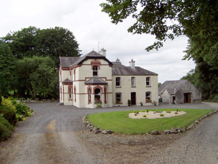 Corbeagh HouseHouse · 1148 yd
Explorer Tom Corbeagh House in County Longford has two distinct phases, so it probably argues with itself when nobody is looking. It’s doing that fancy architectural thing where it changes its mind mid-build. Tell the next person you saw a diva on a hill.
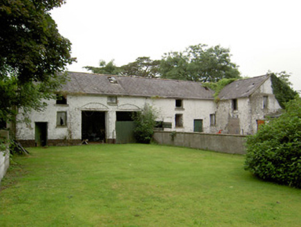 Currygrane HouseOutbuilding · 1368 yd
Explorer Tom Currygrane House describes itself to strangers as 'a bit of a mess, but in a charming way.' The slate roof is holding on for dear life, like a stubborn uncle. Bring the dog, it likes the smell of decay!
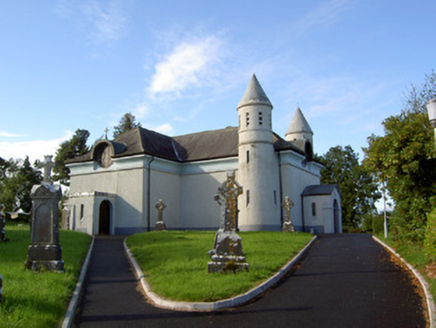 Saint James's Catholic ChurchChurch/chapel · 1609 yd
Explorer Tom Saint James's Catholic Church in Drummeel has more names than a soap opera character and twice as many towers. It was remodeled so hard it lost its original personality entirely. Pack a picnic and an excuse to linger by those round windows.
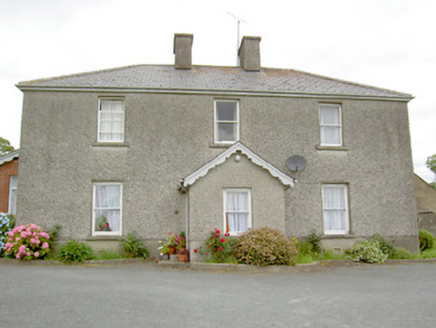 Gorteen HouseHouse · 1.4 mi
Explorer Tom Gorteen House is too plain to post on social media without using fifteen filters, but it’s got that symmetry that makes it look surprisingly cool from a distance. It’s been extended so many times it probably has more rooms than it knows what to do with. Give it a wink; it knows you’re checking out the bay window.
Ballinalee Forest WalkForest · 1.5 miExplorer Tom Ballinalee Forest Walk is suspicious of the postman, honestly, probably because he delivers bad news about the weather. The trees whisper secrets if you listen close enough. Look for the ghost, then pretend you didn't.
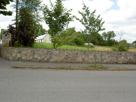 Bully's AcreGraveyard/cemetery, unknown · 1.9 mi
Explorer Tom Bully's Acre in Ballinalee is a graveyard where rabbits think they own the place, but really it holds the rebels from 1798. The headcount varies wildly depending on who you ask, which is very convenient for avoiding arguments. Look out for the recumbent table-like monument and tip your hat.
 Moat of GranardCastle, motte and bailey · 5.8 mi
Explorer Tom The local sheep at Granard Moat rate it a solid four stars for grass quality. Richard de Tuit built it in 1199 to fight rebels, but now it’s mostly a nap zone. Stand back, squint, and it looks like a castle.
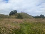 Granard MotteMotte-and-bailey castle remains · 5.8 mi
Explorer Tom Granard Motte would describe the 1800s to a teenager as 'basically a long queue for nothing'. It's just a big mound pretending it remembers something important from the castle days. Spot the oldest stone and give it a name.
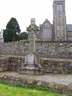 1798 MonumentMonument · 5.8 mi
Explorer Tom The 1798 Monument in Granard uses a Celtic high cross style to tell you about a battle that happened two hundred years ago. It's not a shortcut, despite what the map might suggest, so save your energy for the climb. Look up at the carvings and feel history-heavy.
 Coolamber CastleHouse, fortified house · 7.2 mi
Explorer Tom Coolamber Castle House is where Saint Patrick would have said, ‘You’ve got a bit of an ego for a pile of rocks.’ Cromwell besieged it, so it’s definitely seen some things. Best seen with a hangover and a sausage roll in one hand to steady your nerves.
 Sheela-na-gig in AbbeylaraSheela-na-gig · 7.8 mi
Explorer Tom Sheela-na-gig in Abbeylara has been staring into the void for centuries, and I swear she’s judging your outfit while hiding up there on the tower wall like she owns the place. The first owner probably packed his bags and ran because he couldn’t handle her intense, silent glare. A proper spot for a flask of tea and a big think.
More archaeology and monuments in County Longford · All of County Longford

What do you know about this place?Tap to add a comment or ask a question