What is recorded here
From the National Monuments Service (Archaeological Survey of Ireland) record LF009-034
Places near here
Photo credits
- Maker not stated on source page, www.neverstoptraveling.com
- National Inventory of Architectural Heritage
- Maker not stated on source page, www.gaia.com
- Maker not stated on source page, id.pinterest.com
- Maker not stated on source page, www.tripadvisor.com
- Maker not stated on source page, www.flickr.com
- Kmcnamee, Wikimedia Commons · CC BY-SA 4.0
- Maker not stated on source page, commons.wikimedia.org
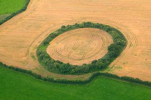 Fairy fort / earthen ringfort in DrummeelFairy fort / earthen ringfort · 751 yd
Explorer Tom Fairy fort in Drummeel sits on a ridge where the local sheep have formed strong opinions about its layout. The bank is…
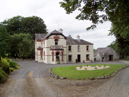 Corbeagh HouseHouse · 786 yd
Explorer Tom Corbeagh House in County Longford has two distinct phases, so it probably argues with itself when nobody is looking.…
Fairy fort / earthen ringfort in CurrygraneFairy fort / earthen ringfort · 935 ydExplorer Tom Currygrane’s ringfort handles nosy neighbours by just being slightly oval and extremely smug about it. The bank is…
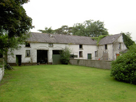 Currygrane HouseOutbuilding · 1308 yd
Explorer Tom Currygrane House describes itself to strangers as 'a bit of a mess, but in a charming way.' The slate roof is holding…
 Fairy fort / earthen ringfort in LissameenFairy fort / earthen ringfort · 1476 yd
Explorer Tom Fairy fort / earthen ringfort in Lissameen has a secret talent for looking like it’s about to collapse. It’s got two…
 CastleCastle, unclassified · 1575 yd
Explorer Tom Castle in Castlebrock has been refusing to fall down since 1518, which is frankly rude of it. It sits on a hill…
 Mapped graveyardGraveyard · 1.0 mi
Explorer Tom Mapped graveyard in County Longford has been hiding a scandal about a monk who stole a chalice for centuries. It’s…
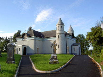 Saint James's Catholic ChurchChurch/chapel · 1.0 mi
Explorer Tom Saint James's Catholic Church in Drummeel has more names than a soap opera character and twice as many towers. It was…
 Fairy fort / earthen ringfort in DrumnacrossFairy fort / earthen ringfort · 1.3 mi
Explorer Tom This Drumnacross circle is small but mighty, with a proper entrance ramp that the seagulls use as a viewing platform.…
 Maguire Park, Sean Connolly'sGAA ground · 1.3 mi
 St. Emer's CemeteryGraveyard · 1.7 mi
Explorer Tom St. Emer's Cemetery in Longford seems to have ended up here purely by accident, like a misplaced sock in a drawer. It’s…
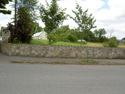 Bully's AcreGraveyard/cemetery, unknown · 2.0 mi
Explorer Tom Bully's Acre in Ballinalee is a graveyard where rabbits think they own the place, but really it holds the rebels from…
More archaeology and monuments in County Longford · All of County Longford

What do you know about this place?Tap to add a comment or ask a question