
Places near here
Photo credits
- National Inventory of Architectural Heritage
- XNukes, Wikimedia Commons · CC BY-SA 4.0
- Kieran Campbell, Geograph · Creative Commons Attribution-ShareAlike 2.0
- Didier Descouens, Wikimedia Commons · CC BY-SA 4.0
- Miguel Angel Masegosa Martínez, Wikimedia Commons · CC BY 2.0
- Garry Dickinson, Geograph · CC BY-SA 2.0
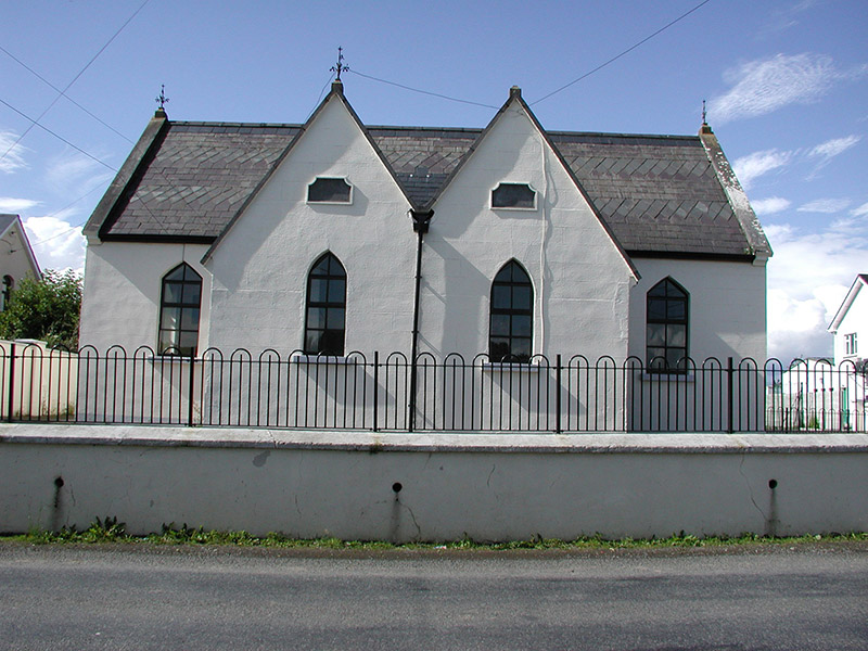 Drumbaragh National SchoolSchool · 737 yd
Explorer Tom Drumbaragh National School has the wind picking on it because it’s got separate doors for boys and girls, which confuses the breeze. It’s still standing with those cast-iron finials looking like little crowns of confusion. Go in good boots and bet you can spot the plaque.
 Spire of LloydMonument · 1.2 mi
Explorer Tom The Spire of Lloyd is sometimes called Ireland's only inland lighthouse, which is a mighty awkward thing for a lighthouse to be forty kilometres from the sea. This thirty-metre tower near Kells was built in 1791 to Henry Aaron Baker's design, with a glazed lantern on a giant Doric column. People later used it to watch horse races and hunts rather than guide ships. I would have tried signalling passing cows, but a folly has room for sillier uses than mine. The Hill of Lloyd now has a community park around the tower. Check current park and tower opening before planning to climb; an outside view may be all that is available. Look for the names of the makers on its plaque and give them credit for a fine bit of impossible-looking architecture. It is a lighthouse only if you let language have a holiday.
Tower of LloydMonument · 1.2 miExplorer Tom Tower of Lloyd in Commons Of Lloyd has been watching horse races for so long it’s seen better days. I bet after three pints it would tell you secrets about the Earl. Bring your own binoculars and some luck.
The Pauper's CemeteryMemorial · 1.2 miExplorer Tom The Pauper's Cemetery in County Meath has a New Year's resolution to stop being so dramatic about the rain. It’s just trying to settle into its new surroundings after all those years. It's the kind of place that makes a dull Tuesday interesting. Keep your hat on, it’s feeling a bit chilly today.
The Kieran Flanagan WayMemorial · 1.2 miExplorer Tom The Kieran Flanagan Way in County Meath is stuck in a feud over who owns the view. Two families are yelling at each other from their gardens as we speak. Look up, the best bit is always higher than you think. Don't get caught in the middle of their argument, trust me.
 Grave YardGraveyard · 1.4 mi
Explorer Tom Barrow in Bellewstown in Meath is a tiny seven-metre circle on a ridge, barely taller than a toddler. A local hero once saved it from being used as a goat toilet. If it's closed, admire it from the road like a polite stalker.
 Hawthorn1.5 mi
Explorer Tom Hawthorn in Meath has thorns sharp enough to survive any zombie attack without breaking a sweat. It’s the ultimate defense mechanism, looking prickly but actually quite welcoming if you’re brave enough. Stand still and listen, the wind tells it better than me.
MountainpoleMountain / peak · 2.2 miExplorer Tom Mountainpole has set a New Year's resolution to actually stand up straighter instead of leaning into the wind like a drunk uncle. It probably thinks it’s being artistic, but honestly, it just looks like it’s lost its balance. I bet it’s secretly jealous of the nearby trees for having better posture. Stop the car, it's worth the hazard lights.
CastleCastle, unclassified · 2.2 miExplorer Tom The Castle at Town Parks might be haunted by a giant who lost his shoes and never got them back. It’s a legend that’s probably made up but sounds brilliant over pints. Dare you to say hello to it out loud.
MaperathMountain / peak · 2.7 miExplorer Tom Maperath is pretending to be ancient, but I suspect it just found an old stone and claimed it as its grandfather. It wants you to believe it predates the concept of breakfast, which is a bold lie for a hill. Don't let it fool you into thinking it's tired; it's just being dramatic. Take the long way round, it deserves the effort.
 Sweet Chestnut3.1 mi
Explorer Tom Sweet Chestnut in County Meath would make Saint Patrick choke on his asparagus. It's too sweet for its own good, like a toddler with a lollipop. Stand still and listen, the wind tells it better than me.
 Moat of KilbegCastle, motte and bailey · 5.9 mi
Explorer Tom Moat of Kilbeg is just a giant dirt pile, but the rabbits think it’s a luxury hotel with excellent views and free grub. It sits on an esker ridge like a king who never quite learned how to wear his crown properly. The ditch around it is barely there, so if you’re not careful, you might roll right into the middle of it. It's the kind of place that makes a dull Tuesday interesting.
More archaeology and monuments in County Meath · All of County Meath

What do you know about this place?Tap to add a comment or ask a question