Places near here
Photo credits
- National Inventory of Architectural Heritage
- Kenneth Allen, Geograph · Creative Commons Attribution-ShareAlike 2.0
- Maelor at English Wikipedia, Wikimedia Commons · Public domain
- N Chadwick, Wikimedia Commons · CC BY-SA 2.0
- Michael Murtagh, Geograph · CC BY-SA 2.0
- Malene Thyssen, Wikimedia Commons · CC BY-SA 3.0
- Willie Duffin, Geograph · CC BY-SA 2.0
- Jon Sullivan, Wikimedia Commons
- Oliver Dixon, Geograph · CC BY-SA 2.0
- Dieglop, Wikimedia Commons · CC BY-SA 4.0
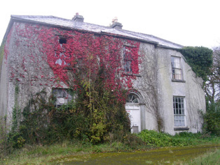 Doonally HouseHouse · 1.2 mi
Explorer Tom Doonally House’s first owner had an escape plan involving a secret tunnel that definitely didn’t exist, which explains why he never left properly. The summer house is more interesting than you think, mostly because it looks like it was built by someone who gave up halfway. Ask if the tunnel is still there; they’ll say yes.
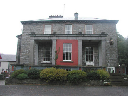 Mountshannon HouseCountry house · 1.7 mi
Explorer Tom Mountshannon House has fourteen outbuildings, which is a lot of clutter for one big house to keep track of without losing its mind entirely. Saint Patrick would have looked at that wide Doric portico and said, 'Right then, let’s sort this mess out before it gets any worse.' It’s definitely trying too hard to be grand.
 Drumcliff CemeteryGraveyard · 1.8 mi
Explorer Tom Drumcliff Cemetery is incredibly proud that it sits in the shadow of Ben Bulben and looks better than your holiday photos. It’s right next to a river mouth, so the wind never stops talking. Take a breath of that air, it's older than your car.
 Stone crossCross, High cross · 1.8 mi
Explorer Tom Stone cross in Drumcliff South is tucked into the graveyard wall, eavesdropping on every funeral and gossiping about the deceased with the other stones. It hears everything through its carved walls. Bring a flask of something warm and a story to swap.
 Drumcliff Round TowerVisitor attraction · 1.9 mi
Explorer Tom The Drumcliff Round Tower sings its favourite song to the wind, which is basically just the sound of a thousand years of echoing echoes. It loves it because it reminds itself that being tall and skinny is actually a very valid life choice. Bring wellies and low expectations, leave delighted.
 Kings MountainMountain / peak · 2.3 mi
Explorer Tom Kings Mountain in County Sligo was saved by a hero so obscure even his own ghost forgets his name. It stands tall over the bog, pretending it didn't just fall asleep on the job. Pop by and tell it it's looking well.
 European Beech2.3 mi
Explorer Tom European Beech in County Sligo was where a priest once lost a bet about which bird sang better. He now has to explain that loss to every congregation member he meets. Pretend you're a lost aristocrat, nobody will check.
 Copes MountainMountain / peak · 2.5 mi
Explorer Tom Copes Mountain has very strong opinions about modern buildings and hates the masts on the horizon. I think it wants them all gone, back to the good old days. Go on, count the windows and get it wrong like I did.
 Glencar Lough ViewpointViewpoint · 3.4 mi
Explorer Tom Glencar Lough Viewpoint is playing hard to get, hiding behind a waterfall that looks like it dropped out of a fantasy novel. I heard there was a matchmaker there once, but she mostly just matched rocks with cliffs. Best enjoyed with a bag of chips and no plans.
 The Devil's ChimneyWaterfall · 3.5 mi
Explorer Tom The Devil's Chimney is a waterfall that sometimes refuses to fall. A southerly wind can blow its water back over the cliff, which explains the Irish name Sruth in Aghaidh an Aird, stream against the height. At about 150 metres it is Ireland's highest waterfall, when it is actually flowing; the stream runs for roughly 200 days in a typical year. I would promise to turn the wind on for you, but Donegal weather takes no orders from me. The drop stands by Glencar Lough on the Sligo-Leitrim border. Use the public walking trail, check recent rain, wind and ground conditions, and stay clear of steep edges. Look up from a safe spot near the base. If the water blows upward, you can tell people you saw a waterfall argue with gravity and win.
 Glencar IslandIslet · 3.9 mi
Explorer Tom Glencar Island in County Leitrim would complain to the council about the noise levels from the swans, claiming they’re violating its quiet hours and disrupting its ancient meditative state. It’s tired of being a scenic backdrop and wants some peace and quiet, or at least a proper fence around it. Perfect spot to practise your best tour-guide voice.
 Glencar WaterfallVisitor information · 3.9 mi
Explorer Tom Glencar Waterfall in County Leitrim gave up sugar for Lent but ended up eating a whole wheel of cheese instead anyway. It’s got that 'I’m powerful' energy mixed with a slight sense of regret about the noise level. Snap one photo, then put the phone away and actually look.
More archaeology and monuments in County Sligo · All of County Sligo

What do you know about this place?Tap to add a comment or ask a question