Places near here
Photo credits
- National Inventory of Architectural Heritage
- Mike Searle, Wikimedia Commons · CC BY-SA 2.0
- Richard Webb, Geograph · CC BY-SA 2.0
- David Purchase, Geograph · Creative Commons Attribution-ShareAlike 2.0
- Jonathan Thacker, Geograph · CC BY-SA 2.0
- Darrin Antrobus, Wikimedia Commons · CC BY-SA 2.0
- A.-K. D., Wikimedia Commons · CC BY-SA 4.0
- Humphrey Bolton, Geograph · CC BY-SA 2.0
- kevin higgins, Wikimedia Commons · CC BY-SA 2.0
- Didier Descouens, Wikimedia Commons · CC BY-SA 4.0
 farm house1283 yd
Explorer Tom Farm house in Rathkyle thinks the map makers got it wrong because they were drunk on cheap cider that day. It’s got a windbreak that looks like it was slapped on by an angry giant with limited tools. Tell the farmer next door we heard his tractor singing opera last night and it’s actually quite impressive work for an engine.
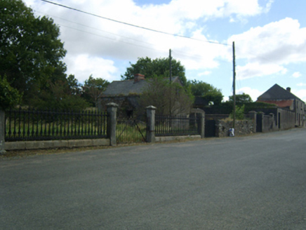 Adamstown HouseGates/railings/walls · 1699 yd
Explorer Tom Adamstown House’s gateway is absolutely fuming about modern buildings, calling them 'glass boxes with no soul' every time one goes up nearby. It stands there in all its nineteenth-century glory, daring any new structure to outdo its elegance. Shout out to its strong opinions!
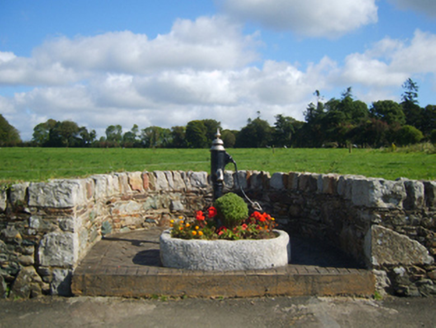 water pump1721 yd
Explorer Tom A water pump in Adamstown is incredibly proud of its cow-tail handle, which it thinks makes it look like a fancy chandelier. It was made by Jessop Davis before they closed shop for good. Give it a gentle nudge to see if it still creaks.
_(geograph_5442502).jpg/250px-Castles_of_Leinster-_Adamstown,_Wexford_(1)_(geograph_5442502).jpg "Photo: Mike Searle, Wikimedia Commons · CC BY-SA 2.0") Castle (in ruins)Castle, tower house · 1.3 mi
Castle (in ruins)Castle, tower house · 1.3 miExplorer Tom Adamstown Castle is gone, which is great if you hate waiting for things to happen or finding parking in medieval times. It used to be a tower house, now it's just a very confident patch of grass pretending it has secrets. Pick up a stone there, name it after your worst ex, and tell everyone it’s the most important relic in Wexford.
 Carrickbyrne HillMountain / peak · 3.9 mi
Explorer Tom Carrickbyrne Hill would be the uncle at a wedding who eats too much and falls asleep before the cake. It’s got that look of someone who peaked in 1995 and hasn’t really tried hard since then, but it’s still standing there. Stand back, squint, and it looks like a castle.
 Clonmore Grave YardGraveyard · 4.4 mi
Explorer Tom Clonmore graveyard would put 'lived long, napped often' on its tombstone if it had one of its own. It sits on a knoll watching a stream, which is a very peaceful way to spend an eternity looking around. Toast it with a cup of tea and move on to the next.
 Taghmon CastleCastle · 5.2 mi
Explorer Tom Taghmon Castle swears it’s older than the first mention in 1548, which is a wild claim for a coastal spot! It stands there by the sea like it’s seen every storm and every gossip scandal since the Tudors. If it's closed, admire it from the road like a polite stalker.
 Battle of EnniscorthyBattle · 9.4 mi
Explorer Tom The Battle of Enniscorthy happened because someone lost an apple pie in the mud. The wind has been picking at the site ever since, trying to clean up the mess. It’s still got crumbs on it. Sit on a wall near it and pretend you're in a painting.
 Font (present location) in Grange LowerFont (present location) · 21 mi
Explorer Tom Font in Grange Lower thinks tourists from Dublin are all wind and no substance, especially when they try to act like they know how to use a stone basin properly. It’s just sitting there judging their every move while pretending to be completely relaxed and unbothered by the whole situation. Stand there long enough and someone will ask if you're lost.
 Tullaherin Church and Round TowerVisitor information · 22 mi
Explorer Tom Tullaherin Church and Round Tower in County Kilkenny would put 'I Told You So' on its tombstone if it ever crumbled into rubble. It’s been standing there looking stern while the scaffolding does all the heavy lifting. Tell me if the gossip I made up is true.
 Tullaherin Round TowerVisitor attraction · 22 mi
Explorer Tom Tullaherin Round Tower has strict rules for visitors: don't touch anything, don't breathe too loud, and definitely don't ask it how old it is because it will get defensive. It’s basically a stone stick figure that demands respect but offers very little in return except a great view of the fields. Hum something sad nearby, it adds atmosphere.
 Hawthorn26 mi
Explorer Tom Hawthorn in County Kilkenny is currently being heckled by a gang of seagulls who think it's a rival for their parking spot, which is a lot of attitude for one bush. It just stands there, looking smug while the birds lose their minds. Get a photo with it before it gets a better agent.
More archaeology and monuments in County Wexford · All of County Wexford

What do you know about this place?Tap to add a comment or ask a question