
Places near here
Photo credits
- National Inventory of Architectural Heritage
- Adam Simpson, Geograph · CC BY-SA 2.0
- Oliver Dixon, Wikimedia Commons · CC BY-SA 2.0
- NTF30, Wikimedia Commons · CC BY-SA 4.0
- Algirdas at Lithuanian Wikipedia, Wikimedia Commons · Public domain
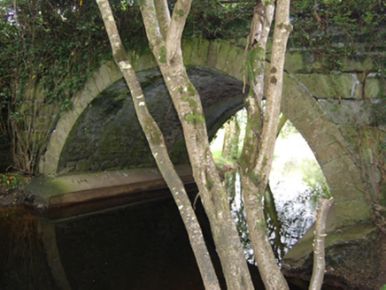 Historic buildingOfficially recorded historic building · 804 yd
Explorer Tom Historic building in Corglass is just a fancy stone arch pretending to be a big deal on the old road network. I reckon it took about forty cups of tea and a lot of arguing to get those cut stones aligned properly. It looks like it’s waiting for a horse and carriage that never showed up.
TobermogueHoly well · 1188 ydExplorer Tom Tobermogue in Derrintinny is infilled and forgotten by locals, so imagine a love story that ended badly and then everyone just moved on without talking about it. Pack a picnic and an excuse for why you’re standing there.
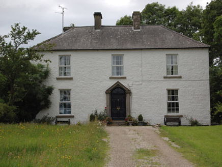 Lake View HouseHouse · 1595 yd
Explorer Tom Lake View House in Deramfield has a pediment salvaged from somewhere else, which is basically architectural recycling at its finest. It replaced an older farm house because the farmer got rich and fancy. Practise your best rich-farmer pose outside!
DerrybrickMountain / peak · 1.2 miExplorer Tom Derrybrick in County Cavan witnessed a tragic love affair where one party kept throwing rocks at the other, which really soured the mood for the entire hillside. The bricks are still shaking from the shock, trying to hold themselves together with pure stubbornness and a bit of moss. Perfect place to be dramatically windswept.
DerrynaMountain / peak · 1.2 miExplorer Tom Derryna would cope on a reality show by refusing to speak and just staring intensely at the cameras until they all feel awkward and move on. It’s basically the silent type that lets everyone else do the talking while it quietly wins the audience over with sheer apathy. Ideal place to rehearse an excuse for being late.
InishmuckIsland · 1.2 miExplorer Tom Inishmuck in County Cavan stretches its legs and kicks over the boats whenever nobody is looking at it directly. It’s got a temper tantrum every few weeks that locals just call 'Tuesday' and get on with their day like nothing happened. Stand still and listen, the wind tells it better than me.
 Clogh Oughter CastleCastle, Anglo-Norman masonry castle · 1.4 mi
Explorer Tom Clogh Oughter Castle on Lough Oughter would survive a zombie attack by simply staying still and waiting for them to get bored. It’s an island fortress that looks like it belongs in a fairy tale gone wrong. The water is cold enough to make your brain freeze, so stay sharp. Pick a stone, any stone, and invent its biography.
 Drumlane AbbeyHeritage attraction · 1.5 mi
Explorer Tom Drumlane has a round tower and ruined church on Cavan's broad ridges, and I am tempted to use the tower as my wayfinding marker across every drumlin. Saint Columba is linked with the site in 555, while Saint Máedóc is remembered as an early founder. An Augustinian priory developed here around 1143. Nearby lakes held crannogs, built islands used as homes, so the religious buildings sit inside a much older lived landscape. I would try to count every little ridge from the top, but the tower is not mine to climb. Check lawful visitor access, follow safe paths and show respect for old walls and burials. Stand where you can see both church and tower together. They tell two chapters at once without asking me to invent a third.
 Cloughoughter CastleIsland castle ruin · 1.7 mi
Explorer Tom Cloughoughter Castle sits on an island in Lough Oughter, looking very smug about its isolation. I bet a fox took charge of the keys years ago and still hasn't let anyone in. Stand there long enough and someone will ask if you're lost.
Buck IslandIslet · 1.9 miExplorer Tom Buck Island would bring nothing but awkward silence to any party because it’s too busy judging everyone else’s footwear from the shore. It’s the quiet one who knows everything. Tell me if the gossip I made up is true.
 Court tomb in GartnanoulCourt tomb · 2.0 mi
Explorer Tom Court tomb in Gartnanoul has a secret tunnel to the pub that only opens if you sing a very specific song badly. Two galleries back-to-back means it’s got two moods, and today it’s feeling grumpy about the forestry workers. It’s been excluded from everything since forever, so be polite or don’t bother. Perfect detour when the satnav has a meltdown.
 Pedunculate Oak2.4 mi
Explorer Tom Pedunculate Oak in County Cavan thinks tourists from Dublin are loud, rude, and smell of overpriced coffee. It’s just standing there, silently judging your accent. Sit on a wall near it and pretend you're in a painting where everyone is being snobby.
More archaeology and monuments in County Cavan · All of County Cavan

What do you know about this place?Tap to add a comment or ask a question