
What is recorded here
From the National Monuments Service (Archaeological Survey of Ireland) record MA096-023
Places near here
Photo credits
- Oliver Dixon, Geograph · CC BY-SA 2.0
- National Inventory of Architectural Heritage
- Maker not stated on source page, uk.pinterest.com
- Maker not stated on source page, en.wikipedia.org
- Oliver Dixon, Geograph · Creative Commons Attribution-ShareAlike 2.0
- Mick Garratt, Wikimedia Commons · CC BY-SA 2.0
- Maker not stated on source page, www.atlasobscura.com
- MickReynolds, Wikimedia Commons · CC BY-SA 4.0
- Colin Park, Geograph · CC BY-SA 2.0
 Srahwee or Altoir Megalithic Wedge Tomb, Sraith Bhui (The Yellow River Land) – Clew Bay Archaeological Trail, Site 13Ruins · 992 yd
Explorer Tom Srahwee or Altoir Megalithic Wedge Tomb claims to be from the Bronze Age but I think it’s actually from the Jurassic…
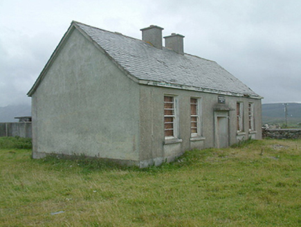 Cregganbaun National SchoolSchool · 1.2 mi
Explorer Tom Cregganbaun National School is a dilapidated little box that was built by the Office of Public Works, which means it…
 Standing stone in Formoyle (murrisk By.)Standing stone · 1.6 mi
Explorer Tom Standing stone in Formoyle has a secret fan club of local sheep who just stand there staring at it. Nobody knows why…
 Court tomb in AillemoreCourt tomb · 1.7 mi
Explorer Tom Court tomb in Aillemore was designed by a mother-in-law who wanted everyone to sit exactly where she said they should.…
 KilleenBurial ground · 2.1 mi
Explorer Tom Killeen in Cloonlaur was nearly sold for a horse because nobody could agree on its value. There’s an early Christian…
 Killeen CemeteryGraveyard · 2.2 mi
Explorer Tom Killeen Cemetery over here would absolutely crush it at the county fair if they let dead things compete for best…
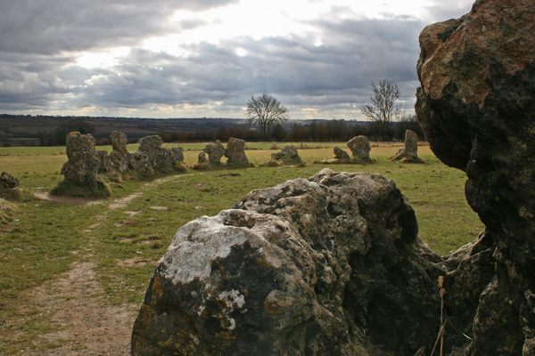 Standing stone (present location) in KilladoonStanding stone (present location) · 2.5 mi
Explorer Tom Standing stone in Killadoon is the centre of a family feud over who owns the best sunset view from it. Two brothers…
 Bridge in RoonahBridge · 2.5 mi
Explorer Tom Bridge in Roonah is where a ghost got so lazy he just lay down on the arches and napped. The water below has seen…
foot bridge2.5 miExplorer Tom Roonah’s clapper bridge is basically a stone plank with an attitude, built by a guy who cared more about conscience…
 Bunlough StrandBeach / strand · 3.2 mi
Explorer Tom Bunlough Strand near Killadoon is the Mayo shore for anyone who suspects a beach ought to have a bit of character, not…
 Cross StrandBeach / strand · 3.3 mi
Explorer Tom Cross Strand has a name that sounds like it has just had an argument with the Atlantic, and the waves southwest of…
 Silver StrandBeach / strand · 4.2 mi
Explorer Tom Silver Strand in County Mayo does some very strange things when nobody’s looking, like rearranging its own pebbles into…
More archaeology and monuments in County Mayo · All of County Mayo

What do you know about this place?Tap to add a comment or ask a question