Places near here
Photo credits
- National Inventory of Architectural Heritage
- Mike Searle, Geograph · CC BY-SA 2.0
- Sailko, Wikimedia Commons · CC BY 3.0
- Arno-nl, Wikimedia Commons · CC BY-SA 4.0
- David Baird, Wikimedia Commons · CC BY-SA 2.0
- Kieran Campbell, Geograph · CC BY-SA 2.0
- Christopher Hilton, Wikimedia Commons · CC BY-SA 2.0
- AndreasDelp, Wikimedia Commons · CC BY-SA 4.0
- Sheila1988, Wikimedia Commons · CC BY-SA 4.0
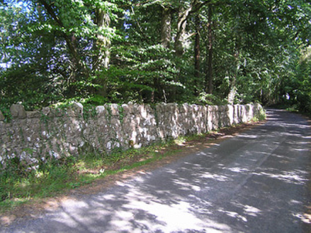 SummersitGates/railings/walls · 213 yd
Explorer Tom Summersit at Derrydarragh is in a bitter feud with the rain, claiming it ruins its limestone complexion every single Tuesday. The walls are just sitting there glaring at the sky, ready to start a shouting match. Practise your Irish on it, it won’t mind.
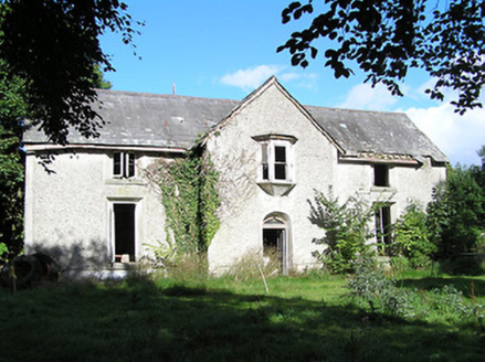 Ballyorney HouseHouse · 616 yd
Explorer Tom Ballyorney House in Lismagawley is derelict but still doing Tudor drama with its ogee-profile doorway. Something dramatic happened there once, maybe a chandelier fell on a vicar’s hat. It’s eclectic and crumbling in a very specific way.
Culnagore WoodForest · 1326 yd Elfeet CastleCastle, Anglo-Norman masonry castle · 1.3 mi
Explorer Tom Elfeet Castle has a secret talent: it can hold its breath for three hundred years without blinking. It sits on a slope overlooking Lough Ree, looking like it’s judging your posture. Grand place for a sulk or a snog, your call.
 Ecclesiastical enclosure in InchbofinEcclesiastical enclosure · 2.3 mi
Explorer Tom Ecclesiastical enclosure in Inchbofin would tell its younger self to stop worrying about the pond levels and start praying harder. Founded by St. Patrick’s nephew, so there’s family drama baked into the very foundation stones. Bring biscuits, every good story needs biscuits and maybe a nap.
 Safe HarbourBay · 2.4 mi
Explorer Tom Safe Harbour would post on social media with a filter that makes it look calm, but we all know it’s actually having a meltdown behind the rocks. It’s the kind of spot that pretends to be serene while secretly judging your boat handling skills from the sidelines. A handy spot to stretch your legs and your imagination.
 Historic town in Warren,rinnaganHistoric town · 2.4 mi
Explorer Tom Historic town in Warren has had more name changes than I've had bad haircuts this year. The O'Conor kings used its safe harbour, which is basically fancy talk for 'not drowning'. Find a local and ask them the real story, then come back and tell me.
 InchbofinIslet · 2.4 mi
Explorer Tom Inchbofin in County Westmeath would write on its dating profile: 'Island with history, no drama.' It’s the island of the white cow, or so the legends keep repeating. Sit on a wall near it and pretend you're in a painting.
 Rindown CastleCastle, Anglo-Norman masonry castle · 2.4 mi
Explorer Tom Rindown Castle would write 'looking for adventure' on its dating profile. It's got a bay nearby, so the views are decent if you ignore the overgrowth. It's free, it's odd, what more do you want?
 RindoonWood · 2.5 mi
Explorer Tom Rindoon in County Roscommon has a hidden message carved into its stones that says 'I told you so' but nobody has managed to find it yet, which is frustrating. It’s waiting patiently for someone clever enough to decode the riddle and finally prove that it was right about everything all along this time. Tell it a joke, it's been a long time since anyone did.
 InchcleraunIsland · 2.7 mi
 Corlea Trackway Interpretative CentreHeritage attraction · 5.5 mi
More historic places in County Longford · All of County Longford

What do you know about this place?Tap to add a comment or ask a question