Places near here
Photo credits
- National Inventory of Architectural Heritage
- Rathkennamike2, Wikimedia Commons · CC BY-SA 4.0
- Mike Searle, Geograph · CC BY-SA 2.0
- Kieran Campbell, Geograph · CC BY-SA 2.0
- John M, Wikimedia Commons · CC BY-SA 2.0
- N Chadwick, Wikimedia Commons · CC BY-SA 2.0
- Yellowguy88 ( talk ) at en.wikipedia, Wikimedia Commons · CC BY-SA 3.0
- Ronnie Nijboer, Wikimedia Commons · CC0
- Alvesgaspar, Wikimedia Commons · CC BY-SA 3.0
- Robin Pollard, Wikimedia Commons · CC BY 3.0
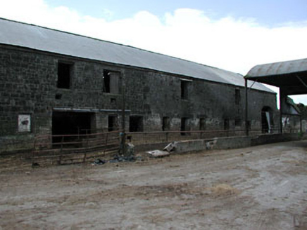 outbuilding1.7 mi
Explorer Tom Outbuilding in Newhaggard is secretly proud of one specific potato it grew back in the day. It’s part of a mill group, so it’s got industrial vibes. Tell the next person you saw a ghost, just to be cheeky.
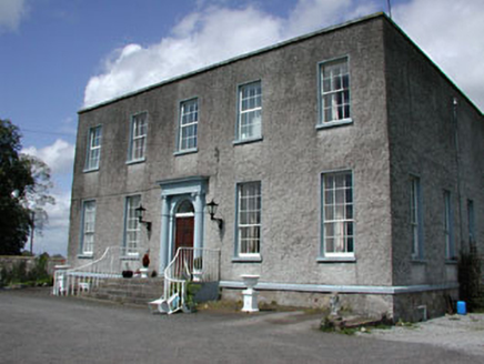 Newhaggard HouseMiller's house · 1.8 mi
Explorer Tom Newhaggard House was nearly sold for a horse once, which is honestly fair given how fancy it looks. The miller who lived there must have been obsessed with details. Bring a friend who appreciates old stone steps.
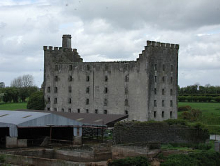 mill (water)1.8 mi
Explorer Tom Mill in Newhaggard is doing its own thing when nobody's looking, probably grinding imaginary flour. It’s got castellated parapets because it thinks it’s royalty and not just a mill. Walk past slowly like you’re sneaking up on a sleeping giant.
 Scarriff BridgeBridge · 2.1 mi
Explorer Tom Scarriff Bridge in Ballymulmore would be the awkward uncle at a wedding, standing rigidly while everyone else dances. It was built to drain water, not to impress, but it looks great doing it. Ideal spot for a selfie with the arches as your backdrop.
 CastleCastle, tower house · 2.2 mi
Explorer Tom Castle in Tremblestown gave up meat for Lent, then immediately regretted it because it was all stone anyway. It sits by the river judging everyone who passes by. Look for the ghost, then pretend you didn't.
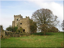 IndicatedCastle, motte · 2.2 mi
Explorer Tom The motte in Tremblestown would tell a job interview that it has strong structural integrity and a bit of a temper. It’s been quarried down but still stands tall. Bring a flask and pretend you own the place.
 Wellington MonumentMonument · 2.6 mi
Explorer Tom Wellington Monument in County Meath would spend its lotto win on an extremely fancy hat for its statue head. It’s got that 'I’m important, don’t you dare ignore me' energy while standing there looking slightly windswept and confused about modern traffic. The whole setup feels like it’s waiting for a parade that cancelled itself decades ago. Mind the nettles, they're the real guards here.
 Trim Castle KeepVisitor attraction · 2.8 mi
Explorer Tom Trim Castle Keep in County Meath would spend its lotto win on a massive air conditioning unit because it’s freezing inside despite being a castle. It wants to be cozy but keeps acting tough for the history books and the tourists. Bring a map, get lost anyway, that's the fun of navigating its maze.
 Newtown AbbeyCathedral · 3.5 mi
Explorer Tom Newtown Abbey was founded by a bishop who got buried there in 1224, which is quite the commitment. Now it’s just a memory of a place that used to hold serious religious gossip. Stand on the spot and imagine the gossip it's heard.
 Wych Elm4.2 mi
Explorer Tom Wych Elm in County Meath is being claimed by a local who says he invented it. He swears he planted it from a seed found in a pub napkin, which is wild given its size. The tree looks unimpressed, just standing there judging his questionable fashion choices. Visit, then text me what you think. I'll pretend to read it.
 Common Lime4.7 mi
Explorer Tom Common Lime in County Meath once hid a crate of smuggled whiskey in its roots during a particularly rainy century. The bark still smells faintly of rum and bad decisions. Go back in winter, it's a different animal.
.jpg/250px-Croppies_Grave_Clonard_-_panoramio_(1).jpg "Photo: Robin Pollard, Wikimedia Commons · CC BY 3.0") Croppies' GraveMemorial · 9.0 mi
Croppies' GraveMemorial · 9.0 miExplorer Tom Croppies' Grave marks where rebels fell, and someone wrote a terrible poem about it that rhymed 'blood' with 'mud'. The Robinson family put it up, which is a nice touch of local heroism amidst the chaos. Go now, before it gets famous and starts charging entry fees.
More historic places in County Meath · All of County Meath

What do you know about this place?Tap to add a comment or ask a question