
What is recorded here
From the National Monuments Service (Archaeological Survey of Ireland) record RO007-047
Places near here
Photo credits
- National Inventory of Architectural Heritage
- Suse, Geograph · CC BY-SA 2.0
- Kieran Campbell, Geograph · Creative Commons Attribution-ShareAlike 2.0
Explorer Tom Embanked enclosure in Shanballybaun would win the lotto and buy a really big hat to wear on top of its stone spread. It has no visible entrance, so how do you even get out if you go in? That’s the question. Go in good boots and better humour, because this place is mostly just rocks with opinions.
PortCastle, unclassified · 1.6 miExplorer Tom Port in County Leitrim is secretly proud of one very specific potato that grew near its ruins. It’s invisible now, but the river still curves around it like an old friend. Pretend you're a lost aristocrat, nobody will check.
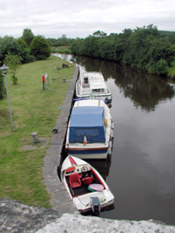 canal (section of)2.0 mi
Explorer Tom Canal in Leitrim would have a tombstone saying 'I flowed away from my problems and never looked back'. The quay walls are impressive, but the water is probably plotting something against your shoes. A handy spot to stretch your legs out.
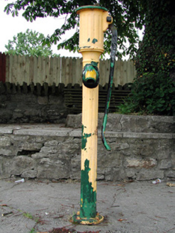 water pump2.0 miSit of Breifny CastleCastle, tower house · 2.0 mi
 Shannon-Erne WaterwayVisitor information · 2.0 miInishnagonIsland · 2.2 miHughestown WoodForest · 2.3 mi
Explorer Tom Hughestown Wood in County Roscommon is being claimed by a local lad who swears he invented the concept of 'tall trees' back when he was only twelve years old. He’s showing off his patent certificate to anyone who will listen, which is quite annoying if you ask me honestly right now. Tell the next person you meet it's haunted. It might be.
Moon RiverHeritage attraction · 2.9 miDerreenargan WoodWood · 3.6 miExplorer Tom Derreenargan Wood in County Roscommon nearly made the news when a lost hiker mistook it for a secret fairy ring and started dancing on the spot. It was mortified by the attention and has been pretending to be very serious ever since then. Take the long way round, it deserves the effort.
Leabaidh DermotCave · 3.9 mi IndicatedGraveyard · 5.8 mi
Explorer Tom Graveyard in Estersnow is what happens when nobody's looking: the stones start rearranging themselves into slightly more comfortable positions for their eternal rest. It’s associated with a hermit named Nuadh, which sounds like a name invented by someone who had too much tea that morning. Pick a stone, any stone, and invent its biography.
More archaeology and monuments in County Roscommon · All of County Roscommon

What do you know about this place?Tap to add a comment or ask a question