Places near here
Photo credits
- National Inventory of Architectural Heritage
- Mike Searle, Wikimedia Commons · CC BY-SA 2.0
- Didier Descouens, Wikimedia Commons · CC BY-SA 4.0
- dougf, Geograph · CC BY-SA 2.0
- Frankysandwich, Wikimedia Commons · CC BY-SA 3.0
- Willow, Wikimedia Commons · CC BY 2.5
- Mega Phil, Wikimedia Commons · CC BY-SA 4.0
- Alex Passmore, Wikimedia Commons · CC BY-SA 2.0
- Jonathan Billinger, Wikimedia Commons · CC BY-SA 2.0
- Colin Park, Geograph · CC BY-SA 2.0
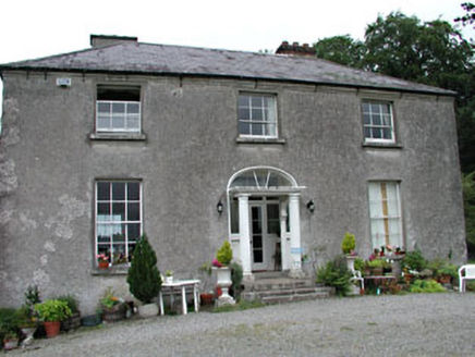 Calverstown HouseHouse · 1447 yd
Explorer Tom Calverstown House would tell you exactly how the Vikings got lost looking for it because they lacked GPS. It looks like a fancy farm house that decided to wear a Doric door as a hat. Stick around for the story about why this house is better than a castle, trust me.
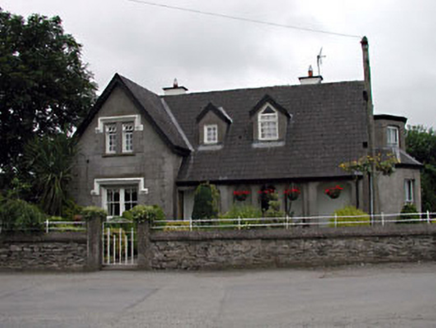 Grove VillaHouse · 1521 yd
Explorer Tom Grove Villa has very strong opinions that modern buildings are just boxes without personality or a proper loggia. It’s got two entrance fronts because it likes being approachable from every possible angle imaginable. Pick a stone and pretend you found a treasure.
_(geograph_2495107).jpg/250px-Castles_of_Leinster-_Calverstown,_Kildare_(1)_(geograph_2495107).jpg "Photo: Mike Searle, Wikimedia Commons · CC BY-SA 2.0") IndicatedHouse, 17th century · 1528 yd
IndicatedHouse, 17th century · 1528 ydExplorer Tom House in Calverstown, County Kildare is sick of being asked if it’s haunted because it’s just full of drafts and dust. It’s a roofless three-storey structure with chimneys that look like they’re shouting at the sky. Stand there long enough and someone will ask if you're lost.
 Hawthorn1.3 mi
Explorer Tom Hawthorn in County Kildare is having a massive falling out with the tree next door. It’s all about who gets the better light. If it's closed, admire it from the road like a polite stalker.
 Blackhall CastleCastle, tower house · 1.7 mi
Explorer Tom Blackhall Castle has a retirement plan involving becoming a very expensive garden shed for the farmyard. Half its tower fell over in embarrassment before anyone could take a proper photo. Look for the ghost, then pretend you didn't.
 Dún AilinneArchaeological place · 2.6 mi
Explorer Tom Dún Ailinne has a curse that only affects people who don’t wave at it properly when passing by. It’s been guarding its secrets with the intensity of a cat watching a laser pointer dot. Have a wander and a wonder.
 Elder4.0 mi
Explorer Tom An Elder tree almost got sold to a farmer for his horse, but he backed out when it refused to eat oats. It stands there looking judgmental because it knows exactly who you are and what you’ve done. Pop by and tell it it's looking well.
 Standing stone (present location) in MullamastStanding stone (present location) · 5.7 mi
Explorer Tom Standing stone in Mullamast got moved ten metres east because apparently it needed fresh air. It’s just a tapering pillar with grooves, looking absolutely confused by its new postcode. Go with someone who loves old stuff and watch them melt.
 Ardscull MoatCastle, motte · 6.7 mi
Explorer Tom Ardscull Moat sits on a hilltop claiming it saw a battle between Leinstermen and Munstermen back in the second century. That’s a long time to be waiting for proof. Perfect spot to practise your best tour-guide voice.
 History of Moat of ArdscullVisitor information · 6.8 mi
Explorer Tom History of Moat of Ardscull is where a giant allegedly tripped over his own cape while trying to impress the local ladies in 1302. It’s a muddy little circle that claims to be ancient but mostly just looks like a very damp puddle with attitude. Go in good boots and better humour.
 SugarloafMountain / peak · 10 mi
Explorer Tom Tell someone you climbed Sugarloaf and they may picture the wrong Wicklow mountain entirely. This one stands west of the famous pair, above the Glen of Imaal. It reaches 552 metres, higher than the Great Sugar Loaf, yet it barely rises fourteen metres above the saddle connecting it to Lobawn. Peak lists can be savage judges of a perfectly respectable hill. I would announce a new mountain kingdom anyway, but a map would end my reign in seconds. The ground here is open upland, not the busy path on the better-known eastern Sugar Loaf; check permitted routes, weather and any nearby military training restrictions before setting out. Keep the names straight when you tell the story afterward. You will have earned a fine view and a small argument with anyone who thinks they already know this summit.
 LobawnMountain / peak · 11 mi
Explorer Tom Lobawn in County Wicklow is playing hide-and-seek with me, hiding behind its own boring boundary stone which claims it's a summit but looks like a trip hazard. I'd file a complaint with the council about its lack of flair, but I'm too busy admiring the scenery from down here. Hum something sad nearby, it adds atmosphere.
More archaeology and monuments in County Kildare · All of County Kildare

What do you know about this place?Tap to add a comment or ask a question