What is recorded here
Situated at the outer edge of a shelf of rock outcrop on a S-facing slope. This is a grass-covered D-shaped area (int. dims 33.5m E-W; 21.5m N-S) defined by a cliff at S (H c. 8m), by an earthen bank (Wth 5-7m; int. H 0.4m at N to 1.2m at E; ext. H 0.3m at N to 1.8m at E) NW-N-SE and a partly rock-cut fosse SW-N-SE…
Read the whole record
From the National Monuments Service (Archaeological Survey of Ireland) record LE022-005
Places near here
Picture notes
- Computer-made picture. It does not show this holy well.
- Computer-made picture. It does not show this monument.
- Willow, Wikimedia Commons · CC BY 2.5
- National Inventory of Architectural Heritage
- Computer-made picture. It does not show this playground.
- Computer-made picture. It does not show this walking route.
- Computer-made picture. It does not show this mountain top.
- Grose, Francis, 1731?-1791; Ledwich, Edward, 1738-1823, continuator, Wikimedia Commons · Public domain
 Holy well in CromlinHoly well · 28 ydTom: I’m here to help · Computer-made picture. It does not show this holy well.
Explorer Tom Holy well in Cromlin has caught my eye in Cromlin, County Leitrim. I bet a holy well with a name like that could keep me talking all afternoon; I'm already inventing a daft little scene for it, and I'll stop before it turns into history.
 Cromlin Bridge WoodWood · 414 yd
Explorer Tom Cromlin Bridge Wood has caught my eye in County Leitrim. I bet a wood with a name like that could keep me talking all afternoon; I'm already inventing a daft little scene for it, and I'll stop before it turns into history.
 Fairy fort / earthen ringfort in DernasmallanFairy fort / earthen ringfort · 473 ydTom: I’m here to help · Computer-made picture. It does not show this monument.
Explorer Tom Fairy fort / earthen ringfort in Dernasmallan has caught my eye in Dernasmallan, County Leitrim. I bet a fairy fort / earthen ringfort with a name like that could keep me talking all afternoon; I'm already inventing a daft little scene for it, and I'll stop before it turns into history.
 European ash1.3 mi
Explorer Tom European ash has caught my eye in County Leitrim. I bet a european ash with a name like that could keep me talking all afternoon; I'm already inventing a daft little scene for it, and I'll stop before it turns into history.
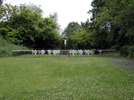 Convent of MercyGraveyard/cemetery · 2.4 mi
Explorer Tom Convent of Mercy has caught my eye in Aghadark, County Leitrim. I bet a graveyard/cemetery with a name like that could keep me talking all afternoon; I'm already inventing a daft little scene for it, and I'll stop before it turns into history.
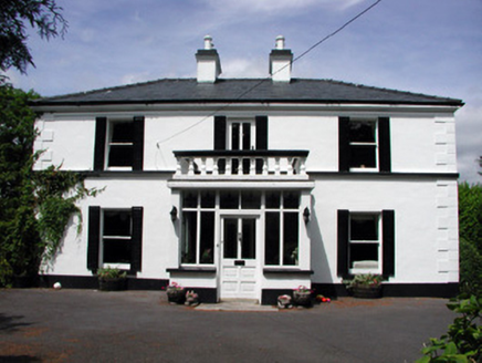 Curranmount HouseHouse · 2.4 mi
Explorer Tom Curranmount House has caught my eye in Aghadark, County Leitrim. I bet a house with a name like that could keep me talking all afternoon; I'm already inventing a daft little scene for it, and I'll stop before it turns into history.
 Children's playground2.5 miTom: I’m here to help · Computer-made picture. It does not show this playground.
Explorer Tom Children's playground has caught my eye in County Leitrim. I bet a children's playground with a name like that could keep me talking all afternoon; I'm already inventing a daft little scene for it, and I'll stop before it turns into history.
Turf IslandIsland · 2.6 miExplorer Tom Turf Island has caught my eye in County Leitrim. I bet a island with a name like that could keep me talking all afternoon; I'm already inventing a daft little scene for it, and I'll stop before it turns into history.
 Crummy LoopWalking route · 3.5 miTom: I’m here to help · Computer-made picture. It does not show this walking route.
Explorer Tom Crummy Loop has caught my eye in County Leitrim. I bet a walking route with a name like that could keep me talking all afternoon; I'm already inventing a daft little scene for it, and I'll stop before it turns into history.
 TullynaconspodMountain / peak · 3.6 miTom: I’m here to help · Computer-made picture. It does not show this mountain top.
Explorer Tom Tullynaconspod is a mouthful of a name for a hill in County Cavan, but it definitely grabs your attention.
 BenbrackMountain / peak · 4.2 miTom: I’m here to help · Computer-made picture. It does not show this mountain top.
Explorer Tom Benbrack is a significant mountain in County Cavan, likely part of a larger range or notable hill group.
 Castle JohnCastle · 6.0 mi
Explorer Tom Castle John has caught my eye in County Leitrim. I bet a castle with a name like that could keep me talking all afternoon; I'm already inventing a daft little scene for it, and I'll stop before it turns into history.
More archaeology and monuments in County Leitrim · All of County Leitrim
What do you know about this place?Tap to add a comment or ask a question