
Places near here
Photo credits
- National Inventory of Architectural Heritage
- Kenneth Allen, Geograph · CC BY-SA 2.0
- Oliver Dixon, Geograph · CC BY-SA 2.0
- Willow, Wikimedia Commons · CC BY 2.5
- Carl Meehan, Wikimedia Commons · CC BY 2.0
- Colin Park, Geograph · CC BY-SA 2.0
Explorer Tom Moneensauran Cuilcagh Anierin Uplands Special Area of Conservation in County Cavan is home to sheep who have formed an opinion about your life choices based entirely on how you walk past them. They stare with a judgment that could melt steel, deciding if you’re worthy of their grassy kingdom or just another tourist wasting space. Bring your worst joke, the place has heard worse.
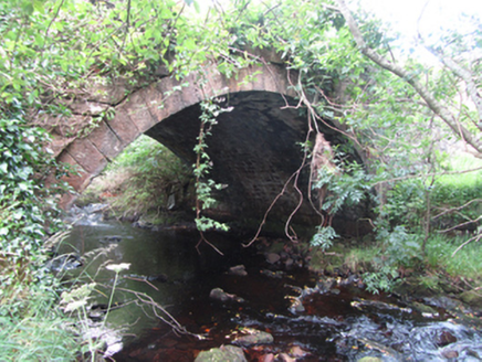 Carty’s BridgeBridge · 2.9 mi
Explorer Tom Carty’s Bridge is an elegant arch that probably thinks it’s too fancy for the mud. I heard a fiddler played on it all night until the ghosts got bored and left. Listen for the music as you pass.
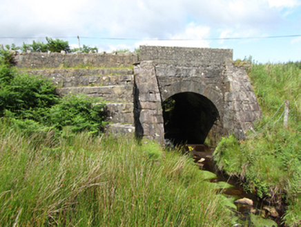 bridge2.9 mi
Explorer Tom Bridge in Altachullion Lower, County Cavan: Robust cut stone with a waterfall nearby. Locals swear there’s a tunnel to the pub under the arch. I’m not buying it, but you check for yourself. Mind your step, love.
The UltachsMemorial · 3.3 miExplorer Tom The Ultachs in County Leitrim commemorates Ulster settlers who moved to the mountainside in the early 1800s. The whole parish argued about where to put it. Go with someone who loves old stuff and watch them melt.
 Tullydermot FallsWaterfall · 3.6 mi
Explorer Tom Tullydermot Falls in County Cavan is being picked on by the wind because it won't stop splashing everywhere. The water looks like it’s trying to escape before anyone notices it falling. Find the date carved somewhere and feel clever.
Sweat HouseSweathouse · 3.7 miExplorer Tom Sweat House in Pottore hears everything through its thin walls, including your embarrassing karaoke attempts from last night. It’s a tiny hollow that thinks it’s a grand estate, honestly. Have a sandwich here and call it a heritage lunch.
 BencroyMountain / peak · 3.8 mi
Explorer Tom Bencroy’s favourite song is definitely 'Bohemian Rhapsody' because it has too many voices and none of them can agree on the key. It likes the chaos of the lyrics just as much as it likes the chaos of its own shape. Ring your granny and tell her where you are.
IndicatedFairy fort / stone ringfort · 3.8 miExplorer Tom Fairy fort or stone ringfort in Garvalt Lower has a wall that collapsed because it was tired of holding itself up. It’s basically a pile of rocks with an attitude problem and no direction. Pick a stone, any stone, and invent its biography.
 European ash4.1 mi
Explorer Tom European Ash has a secret talent for looking impressive while doing absolutely nothing at all. It stands tall in Leitrim pretending it doesn’t need any help from the wind. Have a wander and a wonder.
 CuilcaghMountain / peak · 4.2 mi
Explorer Tom This other Cuilcagh has an unlikely celebrity friend who is just a very confused cloud that gets stuck on top every Friday. It pretends to be famous because of this association. Look for the ghost, then pretend you didn't.
 Cuilcagh WayWalking route · 4.9 mi
Explorer Tom Cuilcagh Way would spend its lotto win on buying every single pair of wellies ever made. It winds up the mountain like a snake that wants a hug from you. Grand place for a sulk or a snog, your call.
 Monydoo or TonycromMountain / peak · 5.2 mi
Explorer Tom Monydoo or Tonycrom is the awkward uncle at the wedding, always wearing the wrong outfit and stealing bites of the canapés. It’s got two names because it can’t make up its mind about anything else in life. Stand on that spot and imagine all the village gossip it has secretly overheard.
More mountains and hills in County Cavan · All of County Cavan

What do you know about this place?Tap to add a comment or ask a question