
What is recorded here
Stretching across two small fields (SW and NE) of rocky pasture, on a gentle SE-facing slope with excellent views of the surrounding landscape ENE-SW and overlooked by higher ground SW-ENE. Associated with a circular enclosure (CL034-249----) in the SW field. Identified on satellite imagery (Digital Globe 2015).…
Read the whole record
From the National Monuments Service (Archaeological Survey of Ireland) record CL034-250
Places near here
Photo credits
- Maker not stated on source page, en.wikipedia.org
- Maker not stated on source page, tr.pinterest.com
- Maker not stated on source page, www.tonyhowell.co.uk
- Maker not stated on source page, www.pinterest.com
- Maker not stated on source page, www.tripadvisor.ie
- Mike Searle, Wikimedia Commons · CC BY-SA 2.0
- P L Chadwick / Geograph Ireland, www.geograph.ie
- Maker not stated on source page, www.dreamstime.com
- National Inventory of Architectural Heritage
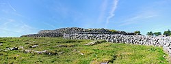 Fairy fort / stone ringfort in CahercallaFairy fort / stone ringfort · 408 yd
Explorer Tom Fairy fort / stone ringfort in Cahercalla was nearly sold for a horse and two cartloads of turnips during a…
 Fairy fort / stone ringfort in Creevagh BegFairy fort / stone ringfort · 425 yd
Explorer Tom Fairy fort / stone ringfort in Creevagh Beg has an imaginary fan club that meets on Tuesdays but never shows up.…
 Earthwork in Creevagh BegEarthwork · 1046 yd
Explorer Tom Earthwork in Creevagh Beg would order a triple chipper with extra mushy peas and ketchup because it’s small but mighty…
 Standing stone in Corbally (bunratty Upper By.)Standing stone · 1108 yd
Explorer Tom Standing stone in Corbally is judging the road that leads to it because it’s too bumpy for its fancy boots. It demands…
 Standing stone in BallyhickeyStanding stone · 1366 yd
Explorer Tom Standing stone in Ballyhickey is just waiting for its lotto win to buy a tiny velvet hat, but it's too shy to tell you.…
 Wedge tomb in BallyhickeyWedge tomb · 1382 yd
Explorer Tom Wedge tomb in Ballyhickey is a national monument, so act important even if the seagulls are mocking your haircut. It’s…
 Danganbrack Castle (in Ruins)Castle, tower house · 1388 yd
Explorer Tom Bawn in Dangan has a bird that refuses to leave, no matter what anyone says. It sits on the wall and watches you like…
 Standing Stone/Pl.Inaug.Dal.PrinceStanding stone · 1427 yd
Explorer Tom Standing Stone/Pl.Inaug.Dal.Prince in Toonagh is standing there looking flat and bored by the Hell River. Rumour says…
 Clooney Quin GAA pitchGAA ground · 1542 yd
 Church in DanganbrackChurch · 1701 yd
Explorer Tom Church in Danganbrack is secretly proud of a potato that grew inside its ruins last summer. It’s just a name on a map…
 Ballymarkahan Castle (in Ruins)Castle, tower house · 1.8 mi
Explorer Tom Ballymarkahan Castle in County Clare is playing hard to get, which is typical for a tower house with no public access.…
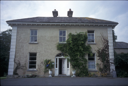 Ballyhannan HouseHouse · 2.3 mi
Explorer Tom Ballyhannan House in Ballyhannan South has interior shutters that might still be hiding secrets from the 1820s. It…
More archaeology and monuments in County Clare · All of County Clare

What do you know about this place?Tap to add a comment or ask a question