
Places near here
Photo credits
- Kmcnamee, Wikimedia Commons · CC BY-SA 4.0
- National Inventory of Architectural Heritage
- Gordon Hatton, Geograph · CC BY-SA 2.0
- Digi-Telly, Wikimedia Commons · CC BY-SA 4.0
Explorer Tom Fairy fort or earthen ringfort in Cloonacool would bring two boggy hollows and a very smug attitude to any party it…
Enclosure in Tullycusheen BegEnclosure · 1.4 miExplorer Tom Enclosure in Tullycusheen Beg would ace a job interview by pointing out its excellent drainage issues and claiming…
Tawnyart WoodWood · 1.9 miExplorer Tom Tawnyart Wood in County Sligo has a New Year's resolution to stop falling over every time the wind picks up, but it…
Ballyara Castle (in Ruins)Castle, unclassified · 2.2 miExplorer Tom Ballyara Castle would be the awkward uncle at a wedding, standing by the buffet. It was quarried away years ago and now…
Castle (Site of)Castle, unclassified · 2.2 miExplorer Tom Castle in Tullanaglug is just a pile of stones pretending to be a giant's breakfast plate. Locals swear a massive…
New WoodWood · 2.3 miExplorer Tom New Wood would tell them in a job interview that it has excellent references from every bird that has ever nested there…
 Cloonacool GAA Community FieldGAA ground · 2.6 mi
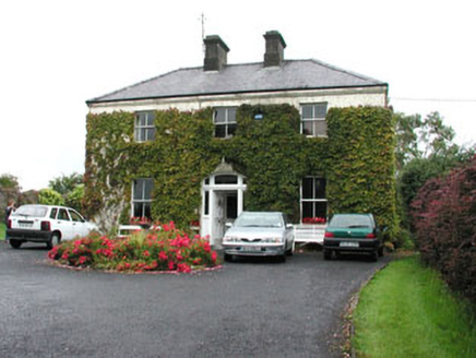 SpringmountHouse · 2.7 mi
Explorer Tom Springmount in Carrowntober bragged about surviving a storm that wasn’t even a strong wind, just a slightly aggressive…
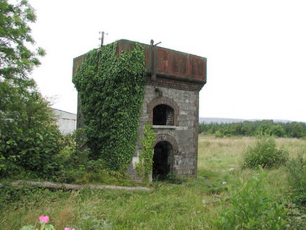 Tobercurry Railway StationBuilding misc · 2.7 mi
Explorer Tom Tobercurry Railway Station uses stone and brick in a way that nobody else in Tobercurry does, which makes it look like…
Kilcoyne Park, Tubbercurry GAAGAA ground · 2.8 mi Mass RockNamed rock · 3.4 mi
Explorer Tom Mass Rock in County Sligo inspired a bad poem that starts with 'Oh rock so tall' and ends with 'It’s really quite a…
 KnocknasheeMountain / peak · 5.0 mi
Explorer Tom Knocknashee hid a fifty-three-acre hillfort in plain sight until an aerial survey made people look properly in 1988.…
More archaeology and monuments in County Sligo · All of County Sligo

What do you know about this place?Tap to add a comment or ask a question