Places near here
Photo credits
- National Inventory of Architectural Heritage
- J. Stirling Coyne, Wikimedia Commons · Public domain
- Ronnie Nijboer, Wikimedia Commons · CC0
- Willow, Wikimedia Commons · CC BY 2.5
- John M, Wikimedia Commons · CC BY-SA 2.0
- N Chadwick, Wikimedia Commons · CC BY-SA 2.0
- Dieglop, Wikimedia Commons · CC BY-SA 4.0
- Yellowguy88 ( talk ) at en.wikipedia, Wikimedia Commons · CC BY-SA 3.0
- Robin Pollard, Wikimedia Commons · CC BY 3.0
- Ilja Klutman from Ballinakill, Ireland, Wikimedia Commons · CC BY-SA 2.0
 Church of Saint Michael and All Angels (Rathmolyon)Church/chapel · 1456 yd
Explorer Tom Church of Saint Michael and All Angels (Rathmolyon) has a curse on it: if you don't wave, your shoelace ties itself. It’s been there since 1797, adding bits here and there just to keep things interesting. Tell it a secret and see if the stained glass blinks.
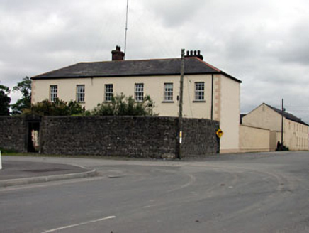 Rathmolyon HouseHouse · 1458 yd
Explorer Tom Rathmolyon House holds a fake world record for being the most dominant building in its streetscape. The carved stone doorcase adds some artistic flair to its serious face. Bring your own legend, I've left mine at home by mistake.
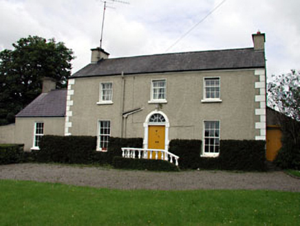 The VillaFarm house · 1503 yd
Explorer Tom The Villa in Rathmolyon is glaring at the new builds next door. It’s got sash windows and a stone doorcase that scream ‘old money.’ It thinks they’re all pretending to be historic. Great spoils for the history buffs out there.
 Dangan CastleCastle, tower house · 1.5 mi
Explorer Tom Dangan Castle thinks Dublin tourists are all wind and no substance because they never stay long enough to appreciate the quiet. It’s been passed down through families so many times it probably has three different surnames in its head. Tell it a joke, it's been a long time since anyone did.
 Wych Elm1.8 mi
 European ash2.1 mi
Explorer Tom European ash in County Meath is the rabbits’ favourite playground, and they think it owes them rent for living there. It’s got a vibe that says “don’t touch me” but invites you to anyway. Take a breath of that air, it's older than your car.
 Wellington MonumentMonument · 4.0 mi
 Trim Castle KeepVisitor attraction · 4.1 mi
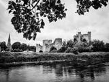 Trim CastleCastle, Anglo-Norman masonry castle · 4.1 mi
 Newtown AbbeyCathedral · 4.2 mi
Explorer Tom Newtown Abbey was founded by a bishop who got buried there in 1224, which is quite the commitment. Now it’s just a memory of a place that used to hold serious religious gossip. Stand on the spot and imagine the gossip it's heard.
.jpg/250px-Croppies_Grave_Clonard_-_panoramio_(1).jpg "Photo: Robin Pollard, Wikimedia Commons · CC BY 3.0") Croppies' GraveMemorial · 9.6 mi
Croppies' GraveMemorial · 9.6 mi Conolly's FollyHeritage attraction · 13 mi
More archaeology and monuments in County Meath · All of County Meath

What do you know about this place?Tap to add a comment or ask a question