
What is recorded here
From the National Monuments Service (Archaeological Survey of Ireland) record CW015-004
Places near here
Picture notes
- Computer-made picture. It does not show this monument.
- National Inventory of Architectural Heritage
- A.-K. D., Wikimedia Commons · CC BY-SA 4.0
- Computer-made picture. It does not show this playground.
- Sarah777, Wikimedia Commons · Public domain
- Computer-made picture. It does not show this walking route.
- A.-K. D., Wikimedia Commons · CC0
- Zapp111, Wikimedia Commons · CC BY-SA 4.0
 Field system in FarranafreneyField system · 677 ydTom: I’m here to help · Computer-made picture. It does not show this monument.
Explorer Tom More field system in Farranafreney, these are conjoined irregular enclosures seen only on satellite imagery. They're basically ghosts of gardens that never grew. Pretend you're a lost aristocrat, nobody will check your ID.
 Fulacht fia in BannagagoleFulacht fia · 820 ydTom: I’m here to help · Computer-made picture. It does not show this monument.
Explorer Tom Another burnt mound in Bannagagole with three troughs and some pits. It’s got range, unlike me on a Sunday. Make a wish, it's had centuries of practice at ignoring you.
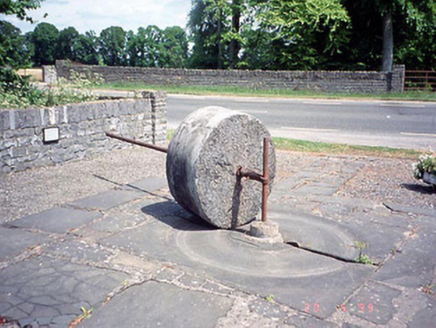 culm crusher1219 yd
Explorer Tom This Culm crusher in Closutton moved house in 1982 because its old spot was too boring. Go on a wet day, it suits the mood. It’s basically a fancy paperweight that used to grind rocks for fun.
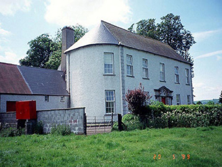 Killinane HouseHouse · 1349 yd
Explorer Tom Killinane House is flexing its bowed ends like it’s showing off at a gym in 1765. The name sounds like it means 'kill the neigh' but I bet it just meant 'lots of cows'. Give it a pat on the way past, it's had a long life.
 Church, GraveyardChurch · 1.1 mi
Explorer Tom Church, Graveyard in Ballyknockan used to be a thing, now it’s mostly a suggestion of a thing. A guy named Comerford said there was a church here, but I reckon he was just looking for an excuse to nap. Ring your granny and tell her where you are.
 Children's playground1.3 miTom: I’m here to help · Computer-made picture. It does not show this playground.
Explorer Tom A Children's playground in County Carlow, where the swings might just carry you right into a daydream.
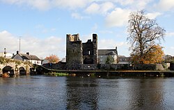 Black Castle (in ruins)Castle, tower house · 1.4 mi
Explorer Tom Black Castle was built to defend the bridge in 1320, so it’s seen some proper traffic over the years. I bet it smells like old stone and regret. Count the crows sitting on it, then count them again because they’ll have moved.
 Rathellen Slí na SláinteWalking route · 1.6 miTom: I’m here to help · Computer-made picture. It does not show this walking route.
Explorer Tom Rathellen Slí na Sláinte is a walking route in County Carlow, great for enjoying the local landscape and tranquility.
 Lock Keeper's House and Lodge MillsVisitor information · 1.8 mi
Explorer Tom The Lock Keeper's House and Lodge Mills in County Carlow showcase the River Barrow’s 18th-century industrial legacy.
 Church (in ruins), GraveyardChurch · 1.8 mi
Explorer Tom Church, Graveyard in Wells is playing hard to get. It’s been there since 1262 but acts like it invented privacy recently. Pick a stone, any stone, and invent its biography.
 Kiddies KingdomChildren's playground · 1.9 miTom: I’m here to help · Computer-made picture. It does not show this playground.
Explorer Tom Kiddies Kingdom in County Carlow sounds like a tiny realm of pure, unadulterated magical fun for the young.
 The Columban WayVisitor information · 2.2 mi
Explorer Tom The Columban Way in Bagenalstown, County Carlow, marks a key point on this historic route through the Irish countryside.
More archaeology and monuments in County Carlow · All of County Carlow

What do you know about this place?Tap to add a comment or ask a question