Places near here
Photo credits
- National Inventory of Architectural Heritage
- 瑞丽江的河水, Wikimedia Commons · CC BY-SA 4.0
- Algirdas at Lithuanian Wikipedia, Wikimedia Commons · Public domain
- Alvesgaspar, Wikimedia Commons · CC BY-SA 3.0
- Robert French, Wikimedia Commons · No restrictions
- Mike Searle, Geograph · CC BY-SA 2.0
Explorer Tom Enclosure in Minard thinks there’s a curse that only affects people who don't wave hello before passing by. It’s been levelled out completely, so you’re just looking at a flat patch of ground and wondering if you made it all up. Bring a pen pal, they'll be jealous.
Fulacht fia in AghadegnanFulacht fia · 1208 ydExplorer Tom Fulacht fia in Aghadegnan, County Longford would write on its dating profile: 'Hot stone lover, looking for someone to boil water with.' It got levelled by drainage works before it could find love. Go on, count the windows and get it wrong like I did.
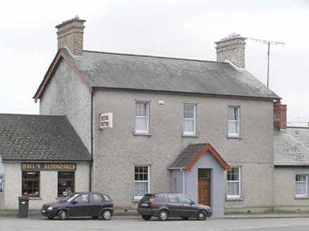 garda station/constabulary barracks1609 yd
Explorer Tom The Garda station or constabulary barracks in Abbeycartron had a cow try to buy it once, and frankly, the price was better than what any human offered. It’s this tall, narrow-windowed building on Battery Road that looks like it’s waiting for someone to tell it the good news. The brick chimneystacks are very distinctive, like little chimney hats for a very serious stone policeman.
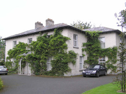 SonasManse · 1691 yd
Explorer Tom Sonas manse claims a poet fell in the ditch nearby and wrote a sonnet about how deep it is. It’s a mid-nineteenth-century building with paired chimneys that look like they’re judging your life choices. Tell your mates you found the secret to happiness.
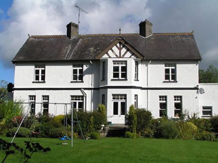 Cartron HillHouse · 1711 yd
Explorer Tom Cartron Hill in Abbeycartron looks like it threw up its hat because Dublin tourists keep asking if it has Wi-Fi. It’s got all those fancy bay windows staring back, judging your outfit for no reason whatsoever. Tip your cap to the architecture snob.
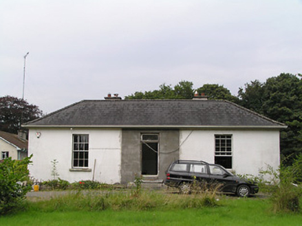 Elm LodgeHouse · 1758 yd
Explorer Tom Elm Lodge is telling you that the shortcut through the garden isn't a shortcut because it leads straight back to where you started, twice. It’s got cast-iron window guards that look like tiny cages for birds that never moved in, which is very unsettling. Flash your phone light if you see it looking suspiciously empty inside.
 Saint Mel's CathedralCathedral · 1.6 mi
Explorer Tom Saint Mel's Cathedral in County Longford refuses to fall down because it’s too stubborn to admit it was built by anyone other than itself. It just keeps standing there, judging everyone’s posture and making sure nobody dares to lean against its ancient walls without paying a small fee in respect. Bring a coin for luck and keep it in your pocket.
 First World War MemorialMemorial · 1.7 mi
Explorer Tom First World War Memorial in Longford refuses to fall down because it’s holding its breath, waiting for someone to notice how impressive it is. It’s stubborn like a mule that knows it’s right, even if you can’t see why. Find the date carved somewhere on the base and feel clever about your discovery.
 Pedunculate Oak2.0 mi
Explorer Tom Pedunculate Oak in County Longford would have made Saint Patrick want to hide his shamrocks just to be safe from its judgmental gaze. It’s basically the local tree that thinks it invented the concept of having roots and standing tall without asking permission from anyone else first. Great spot to propose. Or at least to propose lunch.
 Common Lime2.0 mi
Explorer Tom Common Lime bragged about surviving a storm that flattened everything else in its path. It’s just a tree with an ego problem and great leaves. Bring a friend who talks too much and let the place shut them up.
.jpg/250px-Castle_Forbes,_Longford,_Co._Longford_(21680992271).jpg "Photo: Robert French, Wikimedia Commons · No restrictions") CastleforbesCastle · 2.4 mi
CastleforbesCastle · 2.4 miExplorer Tom Castleforbes does a dramatic moan at midnight that echoes straight into your breakfast toast. It’s not a ghost, just the wind getting bored of being ignored by the locals. Ideal spot for a dramatic phone call.
 Rathcline CastleHouse, fortified house · 11 mi
Explorer Tom Rathcline Castle: The weather has had a long grudge against this place, probably since the Duttons moved in. It’s just one stubborn wall holding its tongue about what happened next. Stand where the owner stood and practise looking smug.
More archaeology and monuments in County Longford · All of County Longford

What do you know about this place?Tap to add a comment or ask a question