
What is recorded here
From the National Monuments Service (Archaeological Survey of Ireland) record CL015-100
Places near here
Photo credits
- Maker not stated on source page, en.wikipedia.org
- Eirian Evans, Geograph · CC BY-SA 2.0
- P L Chadwick, Geograph · CC BY-SA 2.0
- National Inventory of Architectural Heritage
- Jazz Ireland directory; photographer not stated, Jazz Ireland directory
- Maker not stated on source page, tr.pinterest.com
- Joseph Mischyshyn, Geograph · CC BY-SA 2.0
- Maker not stated on source page, commons.wikimedia.org
- Kmcnamee, Wikimedia Commons · CC BY-SA 4.0
 CastleCastle, tower house · 675 yd
Explorer Tom Another castle in Castlequarter that witnessed a love story where the guy brought a goat to dinner. She never forgave…
 Ennistimon HouseHouse · 681 yd
Explorer Tom Ennistimon House in Castlequarter is a c. 1760 house that’s now a hotel, possibly incorporating even older fabric from…
 An Teach CeoilChurch/chapel · 802 yd
Explorer Tom An Teach Ceoil in Sroohil used to be a church but became a music hall in 1989, so it’s got a new personality now. It…
 Ennistimon Market HouseMarket building · 822 yd
Explorer Tom Ennistimon Market House was a butter market, so it smells like money and dairy even in its dreams. Pretend it's yours…
 C. O'LoghlinHouse · 863 yd
Explorer Tom C. O'Loghlin is in a bitter rivalry with the house next door over who has the better dormer window, which is silly…
 CrosbieHouse · 871 yd
Explorer Tom Crosbie hums the blues because it knows exactly how much time has slipped through its fingers since 1870. That little…
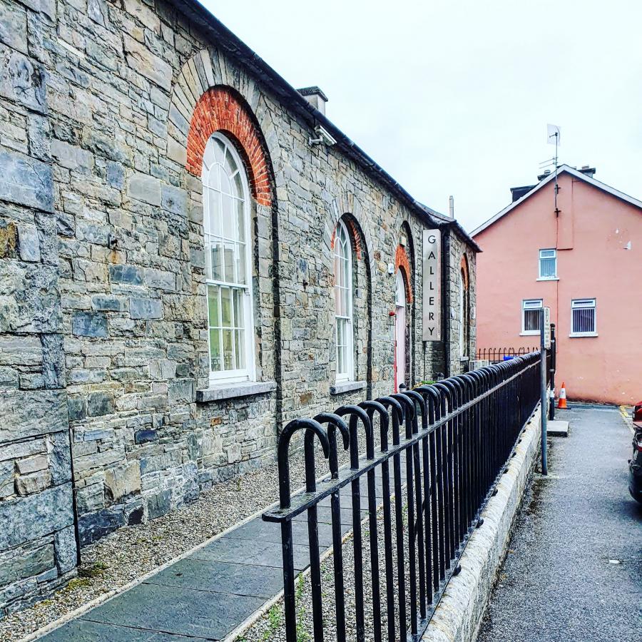 The Courthouse Gallery and StudiosGallery · 1002 yd
Explorer Tom The Courthouse Gallery and Studios gives an old Ennistymon courthouse a new job: letting artists fill rooms once meant…
 Kilmanaheen GraveyardGraveyard · 1024 yd
Explorer Tom Kilmanaheen Graveyard sits on a knoll that just refuses to fall down, standing proud while the marshes below try to…
 Inscribed stone (present location) in EnnistimonInscribed stone (present location) · 1034 yd
Explorer Tom Inscribed stone in Ennistimon is bragging about Fineen FitzPatrick building a castle back in 1619, which is basically…
 Famine MemorialMemorial · 1121 yd
Explorer Tom The Famine Memorial acts like it’s the guest at a wedding who stole the cake, standing there with its arms crossed in…
 Fairy fort / earthen ringfort in Ballingaddy EastFairy fort / earthen ringfort · 1434 yd
Explorer Tom Another Ballingaddy East ringfort is on top of a ridge, probably ordering extra gravy at the chipper. It’s got that…
 Ennistymon GAA pitchGAA ground · 1671 yd
More archaeology and monuments in County Clare · All of County Clare

What do you know about this place?Tap to add a comment or ask a question