
What is recorded here
On a spur of high ground at the E end of a low ridge, N of the Kings River. The site commands good views of the countryside to W, NW and S. A bawn (dims. c. 50m N-S; c. 62m E-W based on enclosed area on 1st (1839 ed. OS 6-inch map) associated with Castle Eve, a multi-period castle complex is defined by a with a fortified house in the SW angle and a substantial mural tower (KK027-024003-) on the NW angle. The E portion of the bawn does not survive. It is constructed of roughly coursed limestone rubble (max. H c. 6.5m; T including base-batter 1.6m; T above base-batter 1.2m). Stretches of the bawn wall are upstanding on the W and N sides, and at the W end of the S side. The best preserved portion is at the W end of the N side (L 26m), which has a pronounced base-batter. A wall-walk runs along the top of the bawn wall and from this the mural tower in the NW angle can be accessed through a first-floor doorway. Outside the bawn, on its W side, there is a broad deep moat which was crossed by a narrow stone-built bridge (Wth 3.5m; L 11.5m) positioned midway along this side. The bridge is flanked on its S side by the N wall of the fortified house. Corbels projecting out from this wall suggest that there may have been a small gate-house building over the bridge. The 1st (1839) ed. OS 6-inch map, as well as the 1948 revision and 25-inch OS map, show a ‘Tower (in ruins)’ at the S end of the W wall of the bawn, which on the 25-inch map is drawn as being flush with the external W wall of the bawn but appears to project beyond the S wall, which suggests it was a mural tower. The fortified house in the SW angle may have been built up against it. See attached:
KK027-024002-_01 View from NW
KK027-024002-_02 From NE, exterior where bawn meets tower
KK027-024002-_03 E end of internal N wall of bawn
Compiled by: Jean Farrelly
Date of upload: 28 March 2023
On a spur of high ground at the E end of a low ridge, N of the Kings River. The site commands good views of the countryside to W, NW and S. A bawn (dims. c. 50m N-S; c. 62m E-W based on enclosed area on 1st (1839 ed. OS 6-inch map) associated with Castle Eve, a multi-period castle complex is defined by a with a fortified house in the SW angle and a substantial mural tower (KK027-024003-) on the NW angle. The E…
From the National Monuments Service (Archaeological Survey of Ireland) record KK027-024002
The monument record does not grant public access. Check the route and ask the landowner before entering private land.
- What survives
- Recorded monument
Places near here
 TowerHouse, fortified house · 38 yd
_-_geograph.org.uk_-_7609027.jpg/250px-Castles_of_Leinster,_Rathculbin,_Kilkenny_(2)_-_geograph.org.uk_-_7609027.jpg "Photo: Mike Searle, Wikimedia Commons · CC BY-SA 2.0") Castle (in ruins)House, 16th/17th century · 722 yd
Castle (in ruins)House, 16th/17th century · 722 yd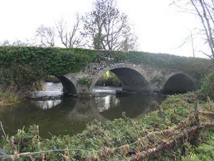 Newtown BridgeBridge · 1218 yd
 Grave YardGraveyard · 1265 yd
 Bawn in Newtown (baker)Bawn · 1272 yd
 ToberakinHoly well · 1.3 mi
 Mill IslandIslet · 1.5 mi
 Lacken WellSpring · 2.3 mi
 Stop 7: Callan's Augustinian FriaryVisitor information · 2.4 mi
 European ash2.4 mi
 Humphrey O'SullivanMemorial · 2.5 mi
 St Mary's ChurchVisitor information · 2.5 mi
Pictures: Mike Searle, Geograph · CC BY-SA 2.0; Mike Searle, Wikimedia Commons · CC BY-SA 2.0; National Inventory of Architectural Heritage; A.-K. D., Wikimedia Commons · CC BY-SA 4.0; kevin higgins, Geograph · CC BY-SA 2.0; Martin Richard Phelan, Wikimedia Commons · CC BY-SA 2.0; Humphrey Bolton, Geograph · CC BY-SA 2.0; Willow, Wikimedia Commons · CC BY 2.5
More castles and forts in County Kilkenny · All of County Kilkenny
What do you know about this place?