
What is recorded here
Castle in Rathculbin has an ivy-choked chimney and a tiny upstairs fireplace. You’d be fierce pleased to announce you’d bought a castle, right up until the first evening, when the family had to take turns warming a hand.
On the summit of a low hill with good views to the N and W. The Down Survey (1655-6) barony map of Kells, Co. Kilkenny, depicts a substantial castle in 'Rathculbyne' with an adjacent gabled house with a chimney at one end (Hibernia Regnum, courtesy of Trinity College Dublin). It is shown on the 1st (1839) ed. OS 6-inch map and the 1948 revision as, 'Castle (in ruins)' and the 25-inch OS map indicates the N gable. Only the N gable (wall T 0.83m; surviving L 5.5m - E end is missing) and a short length of the W wall (L 1.55m) at the NW angle survives of a rectangular three-storey house, composed of roughly coursed limestone rubble. It has a externally projecting chimney (Wth 3.4m; D 0.35m) roughly centrally placed in the gable, which is heavily ivy clad both internally and externally. Internally at first-floor level there are the remains of a small fireplace flanked to the E by a rectangular wall-cupboard. At second-floor features there are two poorly preserved windows (now collapsed) one on either side of the chimney breast and the fragmentary remains of a fireplace. According to local information the greater part of the E side of the house had collapsed in 1954 and the rubble subsequently removed. Also there had been a small archway adjoining the E side of the N gable and the area around the house was formerly cobbled (local information). The depiction on the Down Survey map would suggest that there is also a castle at this location which is no longer visible at ground level. See attached:
KK027-025----_01 Extract from the Down Survey (1655-6) barony map of Kells, Co. Kilkenny (Hibernia Regnum, courtesy of Trinity College Dublin)
KK027-025----_02 N gable - exterior
KK027-025----_03 N gable - interior
KK027-025----_04 N gable - interior - location within yard
Compiled by: Jean Farrelly
Date of upload: 28 March 2023
On the summit of a low hill with good views to the N and W. The Down Survey (1655-6) barony map of Kells, Co. Kilkenny, depicts a substantial castle in 'Rathculbyne' with an adjacent gabled house with a chimney at one end (Hibernia Regnum, courtesy of Trinity College Dublin). It is shown on the 1st (1839) ed. OS 6-inch map and the 1948 revision as, 'Castle (in ruins)' and the 25-inch OS map indicates the N gable.…
From the National Monuments Service (Archaeological Survey of Ireland) record KK027-025
The monument record does not grant public access. Check the route and ask the landowner before entering private land.
- What survives
- Recorded monument
Places near here
Photo credits
- National Inventory of Architectural Heritage
- Mike Searle, Geograph · CC BY-SA 2.0
- A.-K. D., Wikimedia Commons · CC BY-SA 4.0
- Martin Richard Phelan, Wikimedia Commons · CC BY-SA 2.0
- kevin higgins, Geograph · CC BY-SA 2.0
- Eirian Evans, Geograph · CC BY-SA 2.0
- Willow, Wikimedia Commons · CC BY 2.5
- P L Chadwick, Geograph · CC BY-SA 2.0
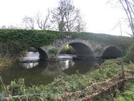 Newtown BridgeBridge · 558 yd
 Bawn in Newtown (baker)Bawn · 704 yd
_Castle_from_entrance_side.jpg/250px-Newtown_(Shea)_Castle_from_entrance_side.jpg "Photo: A.-K. D., Wikimedia Commons · CC BY-SA 4.0") Castle (in ruins)Castle, tower house · 712 yd
Castle (in ruins)Castle, tower house · 712 yd.jpg/250px-Church_ruin_and_graveyard_at_Newtown_(Baker).jpg "Photo: A.-K. D., Wikimedia Commons · CC BY-SA 4.0") Church (in ruins)Church · 818 yd
Church (in ruins)Church · 818 yd Grave YardGraveyard · 826 yd
 ToberakinHoly well · 1.1 mi
 Lacken WellSpring · 1.9 mi
 Mill IslandIslet · 1.9 mi
 Kells Priory Mill MuseumMuseum · 2.1 mi
 European ash2.5 mi
 Burnchurch CastleVisitor information · 2.7 mi
.jpg/250px-Pat_Walsh_memorial_in_Dunnamaggin_(58029).jpg "Photo: A.-K. D., Wikimedia Commons · CC BY-SA 4.0") Pat WalshMemorial · 2.8 mi
Pat WalshMemorial · 2.8 miMore historic places in County Kilkenny · All of County Kilkenny
What do you know about this place?