
What is recorded here
Indicated on the 1st (1839) ed. OS 6-inch map and on the 1948 revision as 'Toberakin'. According to the OS Letters (1839), this holy well is, 'called Tobar a Chinn, i.e., the Well of the Head, but why so called is not known. It is not now frequented for any devotional purpose'. This information is also provided by Carrigan (1905, vol. 3, 329).
From the National Monuments Service (Archaeological Survey of Ireland) record KK027-001002
The monument record does not grant public access. Check the route and ask the landowner before entering private land.
- What survives
- Recorded monument
Places near here
 All Saints' Catholic ChurchChurch/chapel · 636 yd
 Grave YardGraveyard · 1039 yd
.jpg/250px-Church_ruin_and_graveyard_at_Newtown_(Baker).jpg "Photo: A.-K. D., Wikimedia Commons · CC BY-SA 4.0") Church (in ruins)Church · 1046 yd
Church (in ruins)Church · 1046 yd_Castle_from_entrance_side.jpg/250px-Newtown_(Shea)_Castle_from_entrance_side.jpg "Photo: A.-K. D., Wikimedia Commons · CC BY-SA 4.0") Castle (in ruins)Castle, tower house · 1199 yd
Castle (in ruins)Castle, tower house · 1199 yd Bawn in Newtown (baker)Bawn · 1206 yd
 Lacken WellSpring · 1.6 mi
 Burnchurch CastleVisitor information · 1.7 mi
 Kells Priory Mill MuseumMuseum · 1.8 mi
 Kells Loop WalkWalking route · 2.0 mi
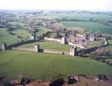 Kells Augustinian PrioryArchaeological place · 2.1 mi
 Font in Glebe (kells By.)Font · 2.2 mi
 Mill IslandIslet · 2.7 mi
Pictures: Neville Goodman, Wikimedia Commons · CC BY-SA 2.0; A.-K. D., Wikimedia Commons · CC BY-SA 4.0; Mike Searle, Geograph · CC BY-SA 2.0; Martin Richard Phelan, Wikimedia Commons · CC BY-SA 2.0; P L Chadwick, Geograph · CC BY-SA 2.0; Eirian Evans, Geograph · CC BY-SA 2.0; Dave Henderson, Wikimedia Commons · CC BY-SA 2.0; kevin higgins, Geograph · CC BY-SA 2.0
More archaeology and monuments in County Kilkenny · All of County Kilkenny
What do you know about this place?