
What is recorded here
On a SW-facing slope, c. 200m N of the Kings River, commanding a good view E-S-W at ground level. The castle is associated with the medieval settlement of Earlstown (KK027-012----) which was under the proprietorship of the Sweetman family, who had succeeded the D’Erleys towards the end of the 14th century (Carrigan 1905, vol. 3, 330). The Sweetman’s held onto possession until the land was confiscated under the Cromwellian confiscations in the mid-17th century and subsequently divided up between several individuals (Carrigan 1905, vol. 3, 330, 332). A bawn, built of roughly coursed limestone rubble (T 1m) enclosed the tower house (KK027-012007-) at Newtown (Baker). Only the S wall (L 23.85m; max. ext. H 2.5m) and ruinous W wall (L 46.5m; max. int. H 2.6m) of the bawn survive upstanding. The S wall is built against the precipitous S-facing slope of the field, though the dramatic drop in ground level may be the result of quarrying.
On a SW-facing slope, c. 200m N of the Kings River, commanding a good view E-S-W at ground level. The castle is associated with the medieval settlement of Earlstown (KK027-012----) which was under the proprietorship of the Sweetman family, who had succeeded the D’Erleys towards the end of the 14th century (Carrigan 1905, vol. 3, 330). The Sweetman’s held onto possession until the land was confiscated under the…
From the National Monuments Service (Archaeological Survey of Ireland) record KK027-012010
The monument record does not grant public access. Check the route and ask the landowner before entering private land.
- What survives
- Recorded monument
Places near here
_Castle_from_entrance_side.jpg/250px-Newtown_(Shea)_Castle_from_entrance_side.jpg "Photo: A.-K. D., Wikimedia Commons · CC BY-SA 4.0") Castle (in ruins)Castle, tower house · 8 yd
Castle (in ruins)Castle, tower house · 8 yd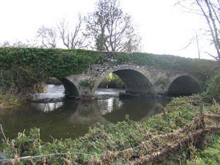 Newtown BridgeBridge · 244 yd
.jpg/250px-Church_ruin_and_graveyard_at_Newtown_(Baker).jpg "Photo: A.-K. D., Wikimedia Commons · CC BY-SA 4.0") Church (in ruins)Church · 250 yd
Church (in ruins)Church · 250 yd Grave YardGraveyard · 253 yd
 ToberakinHoly well · 1206 yd
 IndicatedBawn · 1272 yd
 Lacken WellSpring · 1.6 mi
 Kells Priory Mill MuseumMuseum · 1.9 mi
 Kells Loop WalkWalking route · 2.0 mi
 Kells Augustinian PrioryArchaeological place · 2.1 mi
 Mill IslandIslet · 2.2 mi
 Burnchurch CastleVisitor information · 2.4 mi
Pictures: A.-K. D., Wikimedia Commons · CC BY-SA 4.0; National Inventory of Architectural Heritage; Mike Searle, Geograph · CC BY-SA 2.0; Martin Richard Phelan, Wikimedia Commons · CC BY-SA 2.0; Eirian Evans, Geograph · CC BY-SA 2.0; Dave Henderson, Wikimedia Commons · CC BY-SA 2.0; kevin higgins, Geograph · CC BY-SA 2.0; P L Chadwick, Geograph · CC BY-SA 2.0
More castles and forts in County Kilkenny · All of County Kilkenny
What do you know about this place?