
What is recorded here
In pasture, located at E end of an E–W spine of elevated ground, surrounded to N, E and S by tracts of bog intermixed with reclaimed grassland. To E, the lowlying bog stretches for c.600m to the River Moy. A derelict farmstead lies immediately to SE. A road skirts the rath at SW–NE. Raised circular area or platform…
Read the whole record
From the National Monuments Service (Archaeological Survey of Ireland) record MA050-014
Places near here
Photo credits
- National Inventory of Architectural Heritage
- Didier Descouens, Wikimedia Commons · CC BY-SA 4.0
- Pamela Norrington, Geograph · CC BY-SA 2.0
- Richard Webb, Geograph · CC BY-SA 2.0
- JohnArmagh, Wikimedia Commons · CC BY-SA 3.0
- Alan Reid, Geograph · CC BY-SA 2.0
- Newbert12, Wikimedia Commons · CC BY-SA 4.0
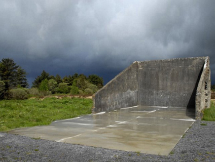 handball alley1.4 mi
Explorer Tom Handball alley in Cornageeha is stuck in a fairy dispute over parking rights for their tiny carriages. They say no humans allowed without a permit or a bribe. Take a breath of that fresh air!
 bridge2.5 mi
Explorer Tom The Bridge in Carns has an opinion of the road leading to it, and that opinion is ‘you’re too bumpy for my delicate arches’. It’s got elegant masonry and forms the main feature of a riverside park, which means people sit there looking at their phones instead of appreciating the craft. Keep your eyes on the river; the bridge is watching you.
Castle (in Ruins)Castle, tower house · 2.5 miExplorer Tom Castle in Belclare has a fox that took full charge of the ruins last Tuesday. The ivy is winning the battle against gravity one leaf at a time. Linger, it's not going anywhere and neither should you.
 Hawthorn2.6 mi
Explorer Tom Hawthorn nearly got famous when a tourist mistook its white flowers for a very aggressive snowstorm and ran away screaming. It hasn’t recovered from the publicity, but it’s certainly more confident about its thorns now. Stick around for the light changing, it's a show.
 Hennigan's Heritage CentreHeritage attraction · 3.8 miProcession Of The SoulsMemorial · 4.1 miYouth Memorial GardenMemorial · 4.4 miBrabazon WoodsForest · 4.4 mi
 Lough Talt TrailVisitor information · 6.4 mi
Explorer Tom Lough Talt Trail has a shortcut that is technically longer if you count the time spent arguing about which way is down. The water supply up there is public, but the ego of this trail seems to be private property. Get there early and have it all to yourself.
 Round Tower7.2 mi
 Largan HillMountain / peak · 7.3 mi
Explorer Tom Largan Hill in County Sligo is strictly run by a terrier who barks at any cloud that passes overhead. The forest below looks young and confused, probably from all the shouting. Perfect detour when the satnav has a meltdown.
 IndicatedWedge tomb · 8.4 mi
More archaeology and monuments in County Mayo · All of County Mayo

What do you know about this place?Tap to add a comment or ask a question