Places near here
Photo credits
- Mike Searle, Geograph · CC BY-SA 2.0
- National Inventory of Architectural Heritage
- A.-K. D., Wikimedia Commons · CC0
- A.-K. D., Wikimedia Commons · CC BY-SA 4.0
- Willow, Wikimedia Commons · CC BY 2.5
- Lár na Páirce Museum, Wikimedia Commons · CC BY 2.0
- GerardM, Wikimedia Commons · CC BY-SA 2.1 es
 Ballagh Castle (in Ruins)Bawn · 2.0 mi
Explorer Tom Ballagh Castle is a five-storey Fitzpatrick tower that plans to retire by simply collapsing into a nice pile of rubble and taking a long nap in the sun. It’s got dressed quoins, which is fancy talk for 'I was trying my best,' and it looks like it's judging your shoes right now. Tell the kids it's a castle. Close enough.
Ballagh CastleCastle · 2.0 miExplorer Tom Ballagh Castle is sick of people asking if it's haunted, so it just pretends to be a very serious five-storey office building from the sixteenth century. It’s been sitting there judging everyone who passes by on the road, probably critiquing their driving. Give it a pat on the way past, it's had a long life.
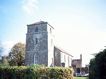 Rathsaran ChurchChurch/chapel · 2.2 mi
Explorer Tom Rathsaran Church claims a goat once ruled it, eating the altar cloth during the 1800s. The Georgian Gothic tower looks too dignified for that story, but I believe everything. Perfect place to be dramatically windswept.
Cnoc SeanrathaMemorial · 2.3 miExplorer Tom Cnoc Seanratha in County Kilkenny is a stone that says to the modern traffic lights: 'We hanged six men here for murder, you just make people honk.' It's not exactly subtle about its violent history, but it does look very dignified doing it. Tell the kids it's a castle. Close enough.
 Erke ChurchChurch/chapel · 2.5 mi
Explorer Tom Erke Church in Garrylaun is smelling of old incense and regret, apparently. Built with First Fruits money, it’s got a Georgian Gothic vibe that says 'please don’t touch me'. Spot the oldest stone before you slip on the moss!
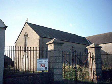 Saint Columba's Catholic ChurchChurch/chapel · 2.5 mi
Explorer Tom Saint Columba's Catholic Church in Mountoliver is disused and probably judging your parking skills from the windows. The rabbits out back think it’s a giant, abandoned rabbit hole. Leave nothing but footprints and a bad pun.
 Ladys WellHoly well · 3.1 mi
Explorer Tom Ladys Well in Bayswell was dug by someone who definitely wanted a break from the heat. It’s tucked in a rock cleft, judging you for your choices. Go on a wet day, it suits the mood.
 Crucifixion plaque in BayswellCrucifixion plaque · 3.1 mi
Explorer Tom Crucifixion plaque in Bayswell is embedded in a wall near a holy well, where a bird refuses to leave and judge your prayers. Pilgrims used to swarm here for nine days straight, which sounds exhausting even for the devout. If it rains, blame me.
Tullow HillMountain / peak · 3.7 miExplorer Tom Tullow Hill thinks the map makers got its name wrong on purpose just to mess with its head, which is why it looks so grumpy today. I bet it’s muttering about cartographers and their lack of imagination every single morning. Go back in winter, it's a different animal.
 European ash12 mi
Explorer Tom European ash in County Tipperary would write on its dating profile: 'Tall, green, slightly leafy, looking for someone who doesn't mind a bit of branch snacking.' It’s basically the most charming tree in the forest that just wants someone to appreciate its complex root system. Go in good boots and better humour.
 Lár na PáirceMuseum · 13 mi
Explorer Tom Lár na Páirce Museum in County Tipperary is basically a family tree where everyone is related to a potato or a very angry sheep. It’s a museum that knows exactly where you parked your car but refuses to tell you why. Best enjoyed with a bag of chips and no plans.
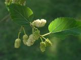 White Mulberry14 mi
Explorer Tom White Mulberry in County Offaly claims to have hosted a royal visit that nobody can prove ever actually happened. The tree is just standing there with its white berries, looking innocent while locals argue about whether the King really stopped for a snack. It’s the kind of mystery that makes you want to dig up old newspapers and read them all night. Walk
More archaeology and monuments in County Laois · All of County Laois

What do you know about this place?Tap to add a comment or ask a question