
Places near here
Photo credits
- National Inventory of Architectural Heritage
- Simes69, Wikimedia Commons · CC BY-SA 4.0
- Richard Webb, Geograph · CC BY-SA 2.0
- Mike Searle, Wikimedia Commons · CC BY-SA 2.0
- Jonathan Thacker, Geograph · CC BY-SA 2.0
- David Hawgood, Wikimedia Commons · CC BY-SA 2.0
- Albolandwex, Wikimedia Commons · CC BY-SA 4.0
- Maker named on the Wikimedia Commons picture page · CC BY-SA 3.0
- Walter Siegmund (talk), Wikimedia Commons · CC BY-SA 3.0
 Old BoleyFarm house · 1.0 mi
Explorer Tom Ballynahown Farmhouse is all about that scenic view, deliberately aligned to show off the rolling grounds like it’s a very posh photographer. It’s got a silver-grey granite doorcase that looks like it cost more than the rest of the house combined, which is cheeky for a farm building. The plan is compact but elegant, suggesting someone wanted to look important even while feeding the horses. If you
 farm house1.6 mi
Explorer Tom Factory in Templeshannon is the Star Mineral Water Factory, built by James Donohoe who clearly thought fizzing water needed a proper headquarters rather than a shed. A fiddler once played here all night long to keep the workers awake for a shift that never seemed to end, according to local legend. It’s got those graduated openings that look like they’re trying to climb out of the building.
 Battle Of The Three RocksMemorial · 2.1 mi
Explorer Tom The Battle Of The Three Rocks would explain the 1800s to a teenager by saying it was basically a group chat gone very, very wrong. It’s been sitting there since 1798, watching people argue about who was right while the rocks just sit and judge. Go in good boots and better humour.
Battle of Three RocksBattle · 2.4 miExplorer Tom The Battle of Three Rocks is suspicious of the postman. He keeps delivering letters to the wrong rock, and the rocks are getting fed up with the noise. They’re threatening to swallow his van next time. Perfect place to be dramatically windswept.
Monumental structure in Shelmaliere Commons (shelburne By., Carrick Ed)Monumental structure · 2.4 miExplorer Tom Monumental structure in Shelmaliere Commons is standing there like it won the lottery and spent it all on granite. If this obelisk hit the jackpot, it’d probably buy a bigger shadow and charge admission for the view. Bring a flask of something warm and a story to swap.
 Forth MountainMountain / peak · 2.5 mi
Explorer Tom Forth Mountain is absolutely sick of being asked if it’s related to the River Forth in Scotland; it’s just a hill, not a geography lesson. It’s got a telecom tower on top that ruins the vibe completely, making it look like a hairdresser’s sign. Find the wonkiest bit and send it to your group chat.
_-_geograph.org.uk_-_3716000.jpg/250px-Castles_of_Leinster,_Barntown,_Wexford_(2)_-_geograph.org.uk_-_3716000.jpg "Photo: Mike Searle, Wikimedia Commons · CC BY-SA 2.0") CastleCastle, tower house · 2.7 mi
CastleCastle, tower house · 2.7 miExplorer Tom Barntown Castle vanished so completely that the map makers must have guessed where they were looking and got spectacularly wrong every single time. Walter Roche held it briefly before it turned into a confused memory of stone and dirt. Bring a flask of something warm and a story to swap.
 Taghmon CastleCastle · 3.0 mi
Explorer Tom Taghmon Castle swears it’s older than the first mention in 1548, which is a wild claim for a coastal spot! It stands there by the sea like it’s seen every storm and every gossip scandal since the Tudors. If it's closed, admire it from the road like a polite stalker.
 Fulacht FiadhVisitor attraction · 3.3 mi
Explorer Tom Fulacht Fiadh is an ancient boiling stone site that would tell you it’s been cooking up secrets since before we had words for them. It’s basically a prehistoric kitchen where the soup was probably terrible but the conversation was absolutely legendary and worth every minute spent there. Stick around for the light changing, it's a show.
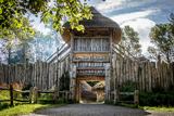 Irish National Heritage ParkHeritage attraction · 3.3 mi
Explorer Tom The Irish National Heritage Park takes you from the first settlers toward the Normans in one walk, which is quicker than my usual telling of the story. Opened near Wexford in 1987, it spreads over about 13.7 hectares of parkland, wetlands and trails. Sixteen reconstructed settings include a Mesolithic camp, a crannóg, a ringfort and a Viking harbour. I would volunteer to build one of them, then discover that even the replica needs more skill than my shed. The guides and craft events help explain what is reconstructed and what is known from actual finds. This is a paid, managed attraction, so check today's hours, tours and any activity bookings before travelling. Allow time for the estuary paths as well as the dwellings. The best question here may be how anyone built a home before they could ring a hardware shop.
 Dawn Redwood3.8 mi
Explorer Tom Dawn Redwood would rate its visitors two stars: 'They stared too long and didn’t bring snacks.' It’s ancient but has the attitude of a diva who knows her worth. Walk past slowly like you're in a film.
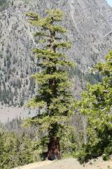 Douglas-fir5.2 mi
Explorer Tom Douglas-fir is actually run by a dog that barks at anyone who climbs too high. It’s got a serious vibe and refuses to acknowledge the birds trying to nest in it. Tell the kids it's a castle. Close enough.
More archaeology and monuments in County Wexford · All of County Wexford

What do you know about this place?Tap to add a comment or ask a question