What is recorded here
Depicted as small roughly square field (c. 18m NNE-SSW; c. 18m WNW-ESE) on 1842 OS 6-inch map, abutting E side of field boundary. In flat marshland, c. 100m SW of Awbeg River. Levelled. To W, low field boundary survives with stream flowing on its W side; N and E sides defined by slight scarp. Interior is dry and used for rough grazing.
From the National Monuments Service (Archaeological Survey of Ireland) record CO016-212
The monument record does not grant public access. Check the route and ask the landowner before entering private land.
- What survives
- Recorded monument
Places near here
Photo credits
- National Inventory of Architectural Heritage
- Christian Pirkl, Wikimedia Commons · CC BY-SA 3.0 at
- Mike Searle, Geograph · CC BY-SA 2.0
- David P Howard, Geograph · CC BY-SA 2.0
- Mike Searle, Wikimedia Commons · CC BY-SA 2.0
- Miguel Angel Masegosa Martínez, Wikimedia Commons · CC BY 2.0
- Unknown author Unknown author, Wikimedia Commons · Public domain
Buttevant Rail DisasterMemorial · 418 yd store/warehouse456 ydMound in RathclareMound · 510 ydDaniel O'Brien TerraceOfficer's house · 979 ydSycamore1489 ydTempleconnell Castle (in Ruins)Castle, tower house · 1.2 miTowerDovecote · 1.7 miLisgriffin CastleCastle · 2.9 miDoneraile CourtGates/railings/walls · 4.6 miDoneraile CourtGate lodge · 4.6 miSweet Chestnut4.8 miBattle of LiscarrollMajor battlefield · 5.1 mi
 store/warehouse456 ydMound in RathclareMound · 510 yd
 Daniel O'Brien TerraceOfficer's house · 979 yd
 Sycamore1489 yd
 Templeconnell Castle (in Ruins)Castle, tower house · 1.2 mi
 TowerDovecote · 1.7 mi
.jpg/250px-Castles_of_Munster-_Lisgriffin,_Cork_(geograph_3036422).jpg "Photo: Mike Searle, Wikimedia Commons · CC BY-SA 2.0") Lisgriffin CastleCastle · 2.9 mi
Lisgriffin CastleCastle · 2.9 mi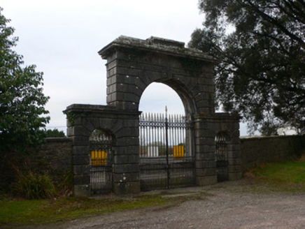 Doneraile CourtGates/railings/walls · 4.6 mi
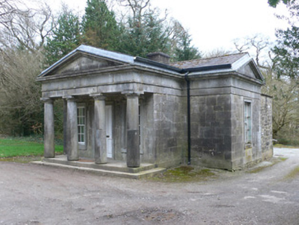 Doneraile CourtGate lodge · 4.6 mi
 Sweet Chestnut4.8 mi
 Battle of LiscarrollMajor battlefield · 5.1 mi
More archaeology and monuments in County Cork · All of County Cork
What do you know about this place?