DDiscover AloneMapAbout

House in Beifleacht

House, vernacular house

What is recorded here

Situated on the SE facing slope of rising ground in mountain valley overlooking valley to the S and E with higher ground to the N and W. A long bog road runs off the S side of the main road ( R254) which runs through the Glenveagh National park. Approximately 1.2km in from the R254 there are a cluster of ruinous…

Read the whole record
Situated on the SE facing slope of rising ground in mountain valley overlooking valley to the S and E with higher ground to the N and W. A long bog road runs off the S side of the main road ( R254) which runs through the Glenveagh National park. Approximately 1.2km in from the R254 there are a cluster of ruinous buildings with several small fields around the ruined house defined by a low stone drystone wall. The main house consists of a two bay single storey high rectangular building built with intermittently coursed granite rubble which is covered with an external render. The main room (int. dims. 4.1m NW-SE x 6.7m NE-SW; wall T 0.6m) of this house is accessed directly from a doorway in the centre of the SE wall, a second room (int. dims. 4.1m NW-SE x 3.9m NE-SW) is accessed through a doorway in the partition wall to the NE of the main room. The front doorway of the house was protected by a projecting porch. The internal walls of the house are covered in a lime render. The main room of this building was heated by a fireplace now mainly broken out that is located in the centre of the SW gable. This fireplace has a stone chimney hood that was supported on corbels which projected into the room of the house in a manner reminiscent of medieval fireplaces. This unusual stone fireplace may suggest that this house was built as early as the 17th century as this type of fireplace construction is not found in the 18th/19th century vernacular houses of this region. Alternatively this farmhouse may have been built in the 18th century with the fireplace built in a manner similar to the houses of the medieval period. The main room was lit by a window located in the SE wall which has evidence for a drawbar slot in the embrasure of the window opening. There is evidence for a second window in the NW wall and possibly a third window in the NW wall of this room. The smaller room to the NE has evidence for only one window which is located in the centre of the SE wall. A third room which is accessed from its own doorway in the SE wall appears to have been built onto the NE gable of this house. During this time an outhouse appears to have been built to the NE of the extension now forming an L-shaped range of buildings. To the SW of the house there is a two bay single storey high building with no evidence of any fireplace which may have been built later than the main house. The fields to the S and E represent the extent of the farmstead around this farmhouse and there is no evidence of any cultivation ridges within the fields which would suggest that they were built to stock livestock.

From the National Monuments Service (Archaeological Survey of Ireland) record DG058-003

The monument record does not grant public access. Check the route and ask the landowner before entering private land.

What do you know about this place?Tap to add a comment or ask a question

What you write will be public.

Places near here

Photo credits
  • Colin Park, Geograph · CC BY-SA 2.0
  • Kenneth Allen, Wikimedia Commons · CC BY-SA 2.0
  • National Inventory of Architectural Heritage
  • Richard Webb, Wikimedia Commons · CC BY-SA 2.0
  • Andreas F. Borchert, Wikimedia Commons · CC BY-SA 3.0 de
  • Maker not stated on source page, commons.wikimedia.org
  • Patrice78500, Wikimedia Commons · Public domain
CrockfaddaMountain / peak · 2.8 mi

Explorer Tom Crockfadda has an undefined summit. I love that the highest point on the mountain doesn't actually exist, so you can…

Crockfadda North-East TopMountain / peak · 3.2 mi

Explorer Tom Crockfadda North-East Top is getting picked on by the wind because it insists on wearing a tiny stone cairn like a hat.…

Cairn, Coolvoy, DoocharyPublicly named cairn · 3.4 mi

Explorer Tom Cairn, Coolvoy, Doochary is a name that sounds like it belongs to a place with a lot of local history and stories. I…

BingormsMountain / peak · 3.4 mi

Explorer Tom Bingorms may sound like a grumble a hill makes after rain, but Na Beanna Gorma means 'the blue peaks'. The name guide…
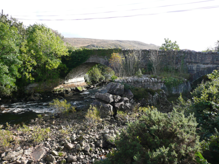
Doochary BridgeBridge · 3.4 mi

Explorer Tom Doochary Bridge would order the biggest chipper in Donegal and claim he ate every single one by himself last Tuesday.…

icehouse3.4 mi

Explorer Tom Icehouse in Derrynacarrow is a round stone building set into a hillside, built around 1860. The survey says it was…

Slieve SnaghtMountain / peak · 3.5 mi

Explorer Tom Slieve Snaght is a mountain / peak in County Donegal where a goat once wore a hat and danced. It was incredibly…

MoylenanavMountain / peak · 3.6 mi

Explorer Tom Right then, folks, here’s Moylenanav, standing tall in the misty corners of County Donegal. I’m still trying to work…
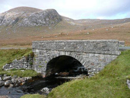
Droichead an Phoill Ghlais [Pollglass Bridge]Bridge · 3.6 mi

Explorer Tom Droichead an Phoill Ghlais [Pollglass Bridge] crosses the River Barra in one broad stone arch, built around 1860.…
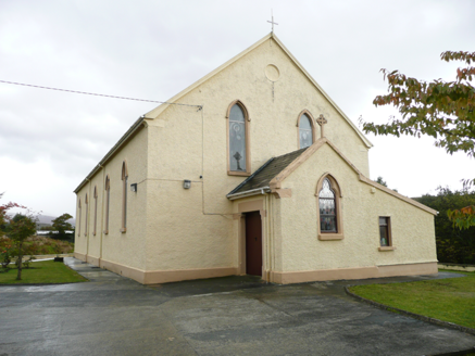
Saint Conal's Catholic ChurchChurch/chapel · 3.6 mi

Explorer Tom Saint Conal's Catholic Church was built in 1833 and altered in 1913. Its pointed windows, stained glass and timber…

Fintown Old Burial GroundBurial ground · 4.1 mi

Explorer Tom Fintown Old Burial Ground sits in a marshy, hummocky field covered in heather. There are zero burial markers to prove…

Páirc Naisiúnta Ghleann Bheatha - Glenveagh National ParkNature reserve · 4.5 mi

Explorer Tom Glenveagh National Park is Donegal giving you room to breathe on a grand scale: lough, bog, woodland and mountain all…

More historic places in County Donegal · All of County Donegal

Add to this placeAdd a picture Add a detailed tip Add a story

Explore the map1,095,414 places to discover

Next place · or swipeCrockfadda