
What is recorded here
From OpenStreetMap (© OpenStreetMap contributors) n332372892
Places near here
Photo credits
- National Inventory of Architectural Heritage
- Patrice78500, Wikimedia Commons · Public domain
- Colin Park, Geograph · CC BY-SA 2.0
- Colin Park, Wikimedia Commons · CC BY-SA 2.0
- Rod Grealish, Geograph · CC BY-SA 2.0
- Chris Gunns, Wikimedia Commons · CC BY-SA 2.0
- Eric in SF, Wikimedia Commons · CC BY-SA 3.0
- Kenneth Allen, Wikimedia Commons · CC BY-SA 2.0
- Ross, Wikimedia Commons · CC BY-SA 2.0
- Andreas F. Borchert, Wikimedia Commons · CC BY-SA 4.0
- David Dixon, Geograph · CC BY-SA 2.0
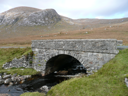 Droichead an Phoill Ghlais [Pollglass Bridge]Bridge · 1068 yd
Explorer Tom Droichead an Phoill Ghlais [Pollglass Bridge] crosses the River Barra in one broad stone arch, built around 1860. Rock-faced granite blocks frame the arch, while the parapet walls have been rebuilt. A single span does the work here, with the hills of Crockbrack and Moylenanav behind it.
 Páirc Naisiúnta Ghleann Bheatha - Glenveagh National ParkNature reserve · 1.1 mi
Explorer Tom Glenveagh National Park follows Lough Veagh through the Derryveagh Mountains, featuring easy trails and historic castle views.
 BingormsMountain / peak · 1.5 mi
Explorer Tom Bingorms may sound like a grumble a hill makes after rain, but Na Beanna Gorma means 'the blue peaks'. The name guide says it belongs to a group of crags above Lough Barra, not just one top. I would let the crags argue over who gets the name.
 Drumnalifferny MountainMountain / peak · 2.0 mi
Explorer Tom Drumnalifferny Mountain is a peak in County Donegal with its access details currently unknown. A photo shows the view towards Slieve Snaght from the summit, which feels like the mountain is showing off its best friend while we are still stuck trying to find the front door.
 Owenwee BridgeBridge · 3.7 mi
Explorer Tom Owenwee Bridge crosses the river on one broad arch, with long rock-faced stones set around its curve. Built around 1860, it looks almost as if the arch stretched each stone to fit. The rubble abutments stay plain by comparison.
 Astelleen Burn WaterfallWaterfall · 4.1 mi
Explorer Tom Astelleen Burn Waterfall, meaning torrent or flood, sloping down three kilometers southwest of Glenveagh Castle is a hidden gem.
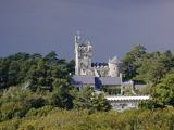 Glenveagh CastleHeritage attraction · 6.2 mi
Explorer Tom Glenveagh Castle looks older than its 1867-to-1873 building date, because it borrows the shape of earlier Irish tower houses. That is quite a costume for a Victorian home. I would give the gardens time too, and check the castle's tour day before setting off.
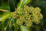 Wheel tree6.3 mi
Explorer Tom A curious Wheel tree in County Donegal offers a unique shape, so check if permission is required.
 Cairn, Coolvoy, DoocharyPublicly named cairn · 6.9 mi
Explorer Tom Cairn, Coolvoy, Doochary has such a long name it sounds like three friends shouting at each other. I bet they built this stone pile just to settle an argument about who was right.
 Glebe House and GalleryHeritage attraction · 7.1 mi
Explorer Tom Glebe House and Gallery lets me visit Derek Hill's home and then see what became of his studio. An 1828 house, art and woodland gardens make quite a three-part outing. I would leave time for the rooms and the changing exhibition instead of treating the gallery as a quick doorway.
 Gartan Ráth Cnó Turas 3 CrossCross · 7.2 mi
Explorer Tom Gartan Ráth Cnó Turas 3 Cross is a bit of a ghost, with its arms barely visible on that rocky mound. It’s part of St Columba’s old pilgrimage route, and I picture the faithful shuffling around in prayer. It’s weathered into a whisper, but it’s still holding the line.
 Glenveagh National Park Visitor CentreVisitor information · 8.1 mi
Explorer Tom Glenveagh National Park Visitor Centre is located on the eastern side of the Derryveagh Mountains, near the 'glen of birches'.
More mountains and hills in County Donegal · All of County Donegal
What do you know about this place?