Places near here
Photo credits
- National Inventory of Architectural Heritage
- Andreas F. Borchert, Wikimedia Commons · CC BY-SA 4.0
- Colin Park, Geograph · CC BY-SA 2.0
- Mike Searle, Geograph · CC BY-SA 2.0
- Hywel Williams, Geograph · Creative Commons Attribution-ShareAlike 2.0
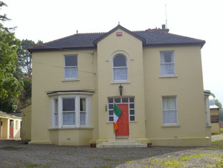 HillsideHouse · 757 yd
Explorer Tom Hillside in Kilfinnane wants to tell the flat that replaced the old mill why it’s superior. The terracotta ridge crestings are fancy, but the house just cares about its status. Hang around for the sunset, it likes being watched.
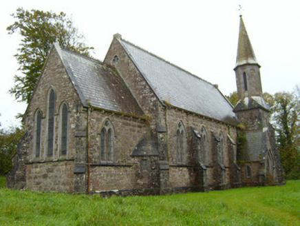 Saint Andrew's Church (Kilfinnane)Church/chapel · 778 yd
Explorer Tom Saint Andrew's Church (Kilfinnane) is Gothic Revival style and thinks it’s bringing the party to a graveyard. Joseph Welland designed it, and it probably brings its own dramatic lighting effects every Sunday. Pretend it's yours and plan a funeral.
Treada Na Ríogh (The Moat), hachuredCastle, motte · 904 ydExplorer Tom Treada Na Ríogh has an imaginary twin across the sea that keeps waving at it. The moat is basically a giant historical shrug right now on the hilltop. Walk past slowly like you're in a film.
Ballyhoura tourist informationVisitor information · 961 ydPalatine's RockNamed rock · 1.4 miBallyhoura WayWalking route · 1.6 miToberpatrickSpring · 2.6 mi ‘Cloigtheach (Round Tower)’Round tower · 2.6 mi
Explorer Tom ‘Cloigtheach (Round Tower)’ in Ardpatrick survived a storm so bad it probably needs therapy now. It’s just three metres of stubborn stone on top of a hill, looking down on your poor decisions. Bring a map, get lost anyway, that's the fun.
 Seefin Mountain East TopMountain / peak · 3.1 mi
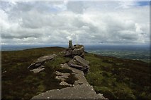 Seefin Mountain West TopMountain / peak · 3.3 mi
 Castle (in ruins)Castle, tower house · 3.9 mi
Explorer Tom Fantstown Castle would describe itself to a stranger as 'slightly damp, historically significant, and currently unavailable'. It’s got a bit of an ego about its muddy foundation. Leave nothing but footprints and a bad pun.
 Grave YardGraveyard · 4.7 mi
More historic places in County Limerick · All of County Limerick

What do you know about this place?Tap to add a comment or ask a question