What is recorded here
From the National Monuments Service (Archaeological Survey of Ireland) record WA003-046001
Places near here
Photo credits
- Maker not stated on source page, www.pinterest.com
- Maker not stated on source page, commons.wikimedia.org
- Maker not stated on source page, www.tripadvisor.co.uk
- Maker not stated on source page, www.asianfanfics.com
- National Inventory of Architectural Heritage
- Maker not stated on source page, www.encirclephotos.com
- Maker not stated on source page, irelandinruins.blogspot.com
- Maker not stated on source page, victorianweb.org
- Rathgormack GAA Club; photographer not named, rathgormack.clubzap.com
 Standing stone in KilballyquiltyStanding stone · 485 yd
Explorer Tom Standing stone in Kilballyquilty is sitting on a slope overlooking a stream that runs like a lazy cat. Its top is…
 CairnCairn, unclassified · 1119 yd
Explorer Tom Cairn in Ballynacurra is unlocated because everyone forgot where it went after the murder at An Leacht. It would cope…
 Church in BallynafinaChurch · 1317 yd
Explorer Tom Church in Ballynafina would say in a job interview that it has excellent references, even if they’re all dead now. It’s…
 Rathgormack Old Parish GraveyardGraveyard · 1.2 mi
Explorer Tom Rathgormack Old Parish Graveyard does something wicked whenever nobody is looking, probably rearranging the headstones…
 Rathgormuck Church (in Ruins)Church · 1.3 mi
Explorer Tom Rathgormuck Church holds a fake world record for 'Most Triangular Graveyard,' which nobody asked for but everyone…
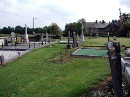 graveyard/cemetery1.3 mi
Explorer Tom Graveyard or cemetery in Carrowleigh has a superstition that if you step on the grass, you owe a penny. Three tombs sit…
 Church in BallindysertChurch · 1.3 mi
Explorer Tom Church in Ballindysert is where a priest once lost a bet involving a bag of potatoes and a very confused donkey that…
 Rathgormuck Castle (in ruins)Castle, tower house · 1.3 mi
Explorer Tom Rathgormuck Castle would bring a bottle of stout and a grudge to any party it ever attended. The Power family lost it…
 Rathgormack Church CemeteryGraveyard · 1.3 mi
Explorer Tom Rathgormack Church Cemetery in County Waterford is clearly run by a very stern terrier that hasn't been walked since…
 Rathgormuck National SchoolSchool · 1.3 mi
Explorer Tom Rathgormuck National School has a ghost who is too lazy to haunt it properly, preferring to nap in the…
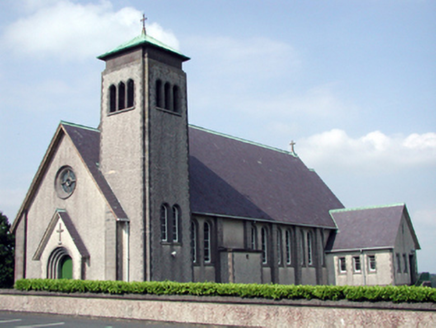 Catholic Church of the Sacred Heart of JesusChurch/chapel · 1.3 mi
Explorer Tom Catholic Church of the Sacred Heart in Carrowleigh would tell its replacement that it’s got better lighting and less…
 Curry Park, RathgormackGAA ground · 1.4 mi
More archaeology and monuments in County Waterford · All of County Waterford

What do you know about this place?Tap to add a comment or ask a question