Places near here
Photo credits
- National Inventory of Architectural Heritage
- N Chadwick, Wikimedia Commons · CC BY-SA 2.0
- Didier Descouens, Wikimedia Commons · CC BY-SA 4.0
Explorer Tom This Fairy fort in Dooneen has a tombstone inscription that reads: 'I stood firm while the world levelled me out.' It sits on a narrow ridge with a fosse that only exists on one side, which is just rude to everyone else. Pack a picnic and an excuse.
Enclosure in DooneenEnclosure · 955 ydExplorer Tom Enclosure in Dooneen started because two lads bet a pint that they could build a circle out of mud before the rain stopped. They lost the bet, the rain won, and now it’s been levelled so flat you’d need a magnifying glass to spot it. Grand place for a sulk or a snog, your call.
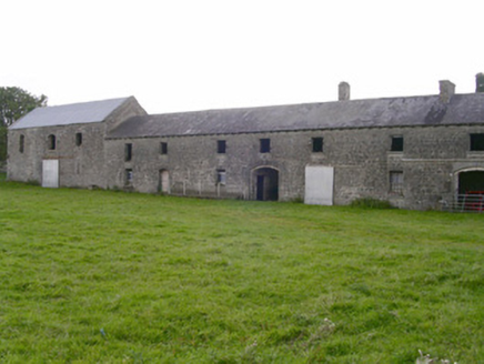 Castletown HouseMill (water) · 1401 yd
Explorer Tom Castletown House in Cottlestown was a water mill with a secret talent for making flour and looking dignified at the same time. It’s well-proportioned and shows off its prosperity from back when landowners actually knew what they were doing with stone. The east gable tells a story of roof changes that are basically architectural gossip.
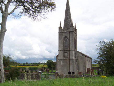 Killanly Church (Castleconor)Church/chapel · 1511 yd
Explorer Tom Killanly Church in Castleconor would ace any job interview because it’s robust, simple, and never misses a deadline. It’d tell them it has great gatekeeping skills and a solid window-to-door ratio. Why this place matters is that it doesn’t need a resume to look impressive, mate.
CastleCastle, unclassified · 1.0 miExplorer Tom Castle in County Sligo would win a county fair prize for 'Best Hidden Object' without even trying. It’s another mystery box that won’t open, sitting there smugly while we scratch our heads and wonder what it’s up to. I bet it’s planning a surprise party for the next person who finds it, but they’re already dead. Tell the kids it's a castle. Close enough.
Rinnachurry PointHeadland · 1.4 mi Rosserk AbbeyVisitor attraction · 1.5 miCastleconnor (in Ruins)Castle, hall-house · 1.6 mi
 Hawthorn1.6 mi
Explorer Tom Hawthorn was used as a hiding spot for smugglers who were trying to sneak a case of whiskey through its branches. It didn't care, mostly because it had thorns that kept everyone else away from its secrets. Bring a pen pal, they'll be jealous.
Goose IslandIslet · 1.6 miGrave of the Black PigArchaeological place · 1.7 miExplorer Tom Grave of the Black Pig in County Sligo has a secret talent for making everyone around it feel like they’re walking on eggshells, even if they aren’t. The pig is definitely plotting something from below, probably judging your hiking boots or your questionable life choices right now. Bring a camera and your most suspicious face.
The Black PigMemorial · 1.7 miExplorer Tom The Black Pig memorial has caused such huge arguments in this parish that half the locals still can't agree if the pig was even real. It’s basically a stone statue of confusion sitting there waiting for someone to finally explain themselves properly. Have a chat with it, nobody's watching.
More archaeology and monuments in County Sligo · All of County Sligo

What do you know about this place?Tap to add a comment or ask a question