What is recorded here
Located on the summit of a high, steep heather clad hill with good extensive views in mountainous area. Large sub circular area (diam 74m E-W) enclosed by two earthen banks and two outer fosses with a causewayed entrance gap (Wth 4m) at WNW. In the N-W sector of the interior there is a low circular mound (diam 4m; H 0.45m) with trig station on top. This mound may have been built to accommodate the trig station. The inner bank (Wth 1.1m; int. H 0.4m; ext. H 1.1m) and outer bank (Wth 3m; ext. H 1m) are best preserved at SE. Intervening fosse (Wth 1m) and external fosse (Wth 0.5m) are also best preserved at this side. To the SW of the site are the possible grass covered remains of a rectangular house site. The hillfort was recently described in the Atlas of Hillforts of Britain and Ireland as following; 'Circular contour fort of approximately 0.8ha enclosed area in commanding position surrounding summit of a steep hilltop at E edge of Slieve Bloom Mountains. Site overlooks a number of tributaries of the Camcor River and is positioned 1.9km to the SW of Cumber Lower hillfort (Atlas No.0696). Bivallate for the entire circuit. Possible original entrance at WNW comprising a simple gap. Possible rectangular hut site at SW of interior. Ramparts survive best at the SE. Interior covered in dense scrub. Commercial forestry plantation abutting enclosing elements to N, E and W. First map depiction in first edition Ordnance survey mapping where the monument is apparent as a circular boundary. Also depicted as a circular boundary in second edition Ordnance Survey maps. Recorded by O'Brien and Sweetman (1997) for the archaeological inventory of Co. Offaly. A series of field boundaries traversing the hillfort interior form the townland boundaries of Ballymacmurragh, Clonlee and Cumber Lower.' (http://hillforts.arch.ox.ac.uk/records/IR0695.html)
The above description is derived from the published 'Archaeological Inventory of County Offaly' (Dublin: Stationery Office, 1997).
Located on the summit of a high, steep heather clad hill with good extensive views in mountainous area. Large sub circular area (diam 74m E-W) enclosed by two earthen banks and two outer fosses with a causewayed entrance gap (Wth 4m) at WNW. In the N-W sector of the interior there is a low circular mound (diam 4m; H 0.45m) with trig station on top. This mound may have been built to accommodate the trig station.…
From the National Monuments Service (Archaeological Survey of Ireland) record OF039-012
The monument record does not grant public access. Check the route and ask the landowner before entering private land.
- What survives
- Recorded monument
Places near here
Cumber HillMountain / peak · 16 ydSaint Dominick's WellSpring · 1372 yd Tulla HouseFarm house · 1.3 miSite of Tulla CastleCastle, unclassified · 1.3 miAghagurty BridgeBridge · 1.4 miStone CrossCross, High cross (present location) · 2.4 miSettlement desertedSettlement deserted, medieval · 3.0 miHawthorn3.1 miHawthorn3.1 miArderinMountain / peak · 3.4 miLeap CastleCastle/fortified house · 4.7 miLeap CastleCastle · 4.7 mi
 Tulla HouseFarm house · 1.3 miSite of Tulla CastleCastle, unclassified · 1.3 mi
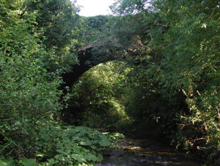 Aghagurty BridgeBridge · 1.4 mi
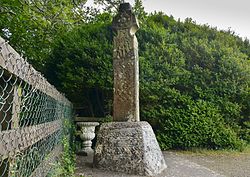 Stone CrossCross, High cross (present location) · 2.4 mi
 Settlement desertedSettlement deserted, medieval · 3.0 mi
 Hawthorn3.1 miHawthorn3.1 mi
 ArderinMountain / peak · 3.4 mi
.jpg/250px-Castles_of_Leinster-_Leap,_Offaly_(geograph_1952754).jpg "Photo: Mike Searle, Wikimedia Commons · CC BY-SA 2.0") Leap CastleCastle/fortified house · 4.7 mi
Leap CastleCastle/fortified house · 4.7 mi Leap CastleCastle · 4.7 mi
Pictures: National Inventory of Architectural Heritage; Zepherb, Wikimedia Commons · CC BY-SA 4.0; Andreas F. Borchert, Wikimedia Commons · CC BY-SA 4.0; Didier Descouens, Wikimedia Commons · CC BY-SA 4.0; Hugh Chevallier, Wikimedia Commons · CC BY-SA 2.0; Mike Searle, Wikimedia Commons · CC BY-SA 2.0; D. Brands, Wikimedia Commons · CC BY-SA 3.0
More archaeology and monuments in County Offaly · All of County Offaly
What do you know about this place?