
What is recorded here
Deserted church, round tower base and twin-earthed enclosure in County Offaly, founded by St. Kieran the elder in the fifth century and still marked by medieval ramparts. By 1568 the canons held six cottages and forty acres beside a thatched stone house used as parish church. A gun turret may have been added at the southeast angle, turning worship into defence before the place emptied. The banks still stand like a forgotten argument between faith, fear and ownership.
National Monument No. 497, consisting of a poorly preserved church (OF039-003005-), base of round tower (OF039-003003-), low motte (OF039-003009-), possible Man-made underground passage (OF039-003026-) and building (OF039-003008-) all of which is contained within the impressive remains of a bivallate ecclesiastical enclosure (OF039-003001-). Founded by St. Kieran the elder in the fifth century (ITA Survey 1943). Medieval earthworks marked on OS 6-inch map as 'Ramparts' enclose the ecclesiastical remains with square shaped motte (OF039-003009-) to the SW of the church. The earthworks consist of two well preserved earthen banks with wide deep intervening fosse and possible ramped entrance at N. Inside the enclosure are several earthen banks which may act as internal divisions. Possible wall footings of a rectangular building orientated on a N/S axis located outside SE angle of graveyard wall as indicated on the OS 6-inch map. An Inquisition of 1568 recorded 'The Villa of Shyre belonged to the Canons, in which were six cottages and forty acres of arable and pasture lands, of the annual value of 6s. 8d.' Surviving evidence suggests an early Christian foundation with early medieval priory, low motte and earthworks which enclose the priory which was later fortified by the addition of a gun turret to the SE angle possibly in the 16th-century. The monastic remains are described in 1568 as consisting of 'The Prior was found seized of the site of the Priory containing one acre, in which were the walls of a Church, a small tower, a great stone house covered with thatch, now used as the Parish Church and two other houses, then the residence of the Canons, worth excluding repairs, 3/4d. yearly.' (O' Flanagan 1933, vol. 2, 59; Barrow 1979, 175-6; Cooke 1875, 166-76; Lionard Vol. 61, 95-169; Harbison 1970, 207)
The above description is derived from the published 'Archaeological Inventory of County Offaly' (Dublin: Stationery Office, 1997). In certain instances the entries have been revised and updated in the light of recent research.
Date of upload: 23 May 2011
The monument record does not grant public access. Check the route and ask the landowner before entering private land.
- What survives
- Recorded monument
Places near here
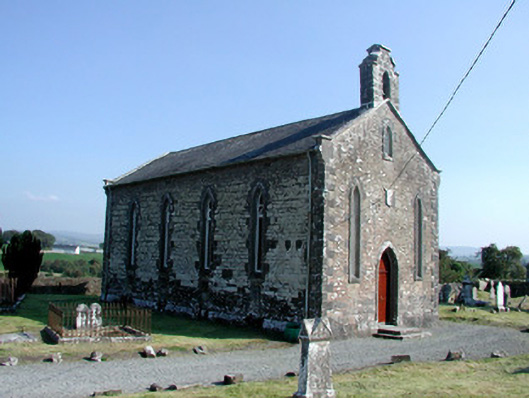 Saint Kieran's Church (Seirkieran)church/chapel · 5 yd
 Base of CrossCross, High cross · 34 yd
 Seir Kierans Abbey (in Ruins), Church (in Ruins)Religious house, Augustinian canons · 42 yd
 Burying GroundGraveyard · 46 yd
 RampartsCastle, motte · 158 yd
 HawthornHawthorn · 457 yd
 Saint Kieran's WellSpring · 594 yd
 Ballymooney Castle in RuinsHouse, fortified house · 1281 yd
 Derrykeel WoodWood · 1.4 mi
 Drummin HillMountain / peak · 2.3 mi
 River WalkWalking route · 4.9 mi
 Birr Heritage CentreMuseum · 5.1 mi
Other information
Photo: Andreas F. Borchert · CC BY-SA 4.0