What is recorded here
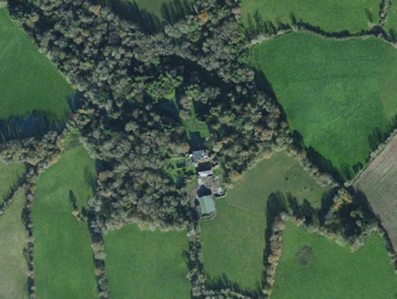
Located on a gentle N-facing slope. This is a raised and overgrown rectangular area (dims. 47m E-W; 44m N-S) with low banks (at W: Wth c. 5m; int. H 0.9m) on the perimeter and raised corners. There is an external flat bottomed moat (Wth of top 6-8m; int. D 2.5-2.9m; ext. D 1.8m) on each side. A small stream enters the moat at the SE corner. (Barry 1977, 214, WX 13)
The above description is derived from the published 'Archaeological Inventory of County Wexford' (Dublin: Stationery Office, 1996).
From the National Monuments Service (Archaeological Survey of Ireland) record WX027-005
Places near here
Photo credits
- National Inventory of Architectural Heritage
- sarah777, Wikimedia Commons · CC BY-SA 2.0
- Bruce Marlin, Wikimedia Commons · CC BY-SA 2.5
- Hywel Williams, Wikimedia Commons · CC BY-SA 2.0
- Michael Dibb, Geograph · CC BY-SA 2.0
 Island HouseCountry house · 1182 yd
 St. Thomass WellHoly well · 1481 ydBallingowan MoteCastle, motte · 1739 yd
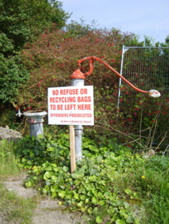 water pump1.7 miKilnamanagh Grave YardArchaeological place · 2.1 miHachured moundCastle, motte · 2.1 miTinnaberna BeachBeach / strand · 2.4 miBirds of PreyVisitor information · 2.6 mi
 1798 MemorialMonument · 2.7 mi
 Fontainebleau service tree2.8 mi
 Tulach a' tSolaisMonument · 3.5 mi
 Morriscastle BeachBeach / strand · 4.1 mi
More archaeology and monuments in County Wexford · All of County Wexford
What do you know about this place?Tap to add a comment or ask a question