Places near here
Photo credits
- National Inventory of Architectural Heritage
- Royalcanalrunner, Wikimedia Commons · CC BY-SA 4.0
- Mike Searle, Geograph · CC BY-SA 2.0
- Dougbermingham at English Wikipedia, Wikimedia Commons · CC0
- Stephan van Helden, Wikimedia Commons · CC BY-SA 4.0
- Alex Passmore, Geograph · CC BY-SA 2.0
- Ronnie Nijboer, Wikimedia Commons · CC0
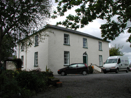 The Old RectoryHouse · 1.1 mi
Explorer Tom The Old Rectory in Carbury brags about surviving storms that would have flattened a normal house into dust. It’s basically a brick fort with a hub-and-spoke fanlight and a massive ego attached. Stand still and list
Bog OakMonument · 1.2 miExplorer Tom Bog Oak is a monument with a long-standing grudge against the weather because it keeps getting rained on while it tries to rot gracefully. It’s basically a tree that decided to become a statue and never fully committed to the pose. It's the kind of place that makes a dull Tuesday interesting.
Trinity WellHoly well · 1.2 miExplorer Tom Trinity Well at Demesne is the life of the party on Trinity Sunday, acting like the source of the River Boyne makes it the king of all hydration stations. It’s a lucky spot for pilgrims who drink deep enough to forget their troubles and start believing in miracles that are mostly just good water pressure. Go on, count the windows and get it wrong like I did.
 Ticknevin LockLock · 1.2 mi
Explorer Tom Ticknevin Lock was born from a pub bet about who could move the most water. It’s a civil engineering masterpiece that still has a weathered benchmark for good measure. Pretend it’s raising you up to glory.
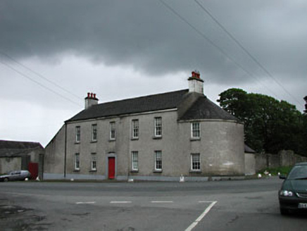 Carbury HouseHouse · 1.3 mi
Explorer Tom Carbury House dominates the village like a king who never left his throne. The seagulls say it’s just a big fancy box with no secrets. Go before the tourists find out it’s just bricks and stone pretending to be grand.
 IndicatedHouse, fortified house · 1.6 mi
Explorer Tom House in Carbury gave up its corbels for Lent because it felt too heavy. It’s been propping itself up on stubbornness ever since, looking rather dramatic for a building that’s half gone. Pick a stone, any stone, and invent its biography.
 Carbury CastleCastle · 1.6 mi
Explorer Tom Carbury Castle has a hill full of building periods and a local tale about Saint Patrick that I would never dare pass off as a fact. The first Norman earthwork came before later stone defences. Pierce St Leger is linked with a thirteenth-century castle, while the most striking ruins on the hill are a Tudor house of the Colley family. I would tell you which wall belonged to which cousin without hesitation, then get the century wrong, so bring a good site account. The position near the Kildare-Offaly border explains why several families wanted it. Check current lawful access before crossing land and avoid climbing broken walls or earthworks. View the whole hill from below first. Carbury is less one castle than a family of structures arguing for the best spot.
 Horse-chestnut2.3 mi
Explorer Tom Horse-chestnut drops stones that are secretly messages from the future if you squint really hard at them. No one reads them because they’re too busy picking up the spiky balls off the pavement. Bring a flask and pretend you own the place while you do it.
The Fairy BowerHeritage attraction · 4.8 miExplorer Tom The Fairy Bower holds a fake world record for being the most overrated tree structure in County Kildare. It claims to be ancient but I’m pretty sure it was planted by a bored gardener last Tuesday. Pretend it's yours and plan the housewarming.
Lullymore Heritage ParkHeritage attraction · 4.8 miExplorer Tom Lullymore Heritage Park would post on social media: 'Just another day of pretending to be ancient while the tour groups take selfies in front of my ruins.' It’s probably tired of explaining why the castle fell down but keeps doing it with a smile. Go before the tourists find out.
 Grand Canal WayVisitor information · 8.3 mi
Explorer Tom Grand Canal Way is full of secrets that only come out after three pints, like which bridge was built by a love-struck engineer who named it after his dog. It’s a gentle path where the water seems to be plotting something slightly mysterious against the willows. Stick around for the light changing, it's a show.
 Wych Elm12 mi
Explorer Tom Wych Elm in County Meath is being claimed by a local who says he invented it. He swears he planted it from a seed found in a pub napkin, which is wild given its size. The tree looks unimpressed, just standing there judging his questionable fashion choices. Visit, then text me what you think. I'll pretend to read it.
More archaeology and monuments in County Kildare · All of County Kildare

What do you know about this place?Tap to add a comment or ask a question