What is recorded here
Marked faintly as the outline of an oval enclosure (dims c. 60m E-W; c. 45m N-S) on the 1839 ed. of the OS 6-inch map. Situated towards the top of the W-facing slope of a small N-S spur in the foothills of the Blackstairs Mountains. No feature is visible at ground level in pasture.
From the National Monuments Service (Archaeological Survey of Ireland) record WX014-003
The monument record does not grant public access. Check the route and ask the landowner before entering private land.
- What survives
- Recorded monument
Places near here
Photo credits
- National Inventory of Architectural Heritage
- Sarah777, Wikimedia Commons · Public domain
- No machine-readable author provided. Voyager assumed (based on copyright claims)., Wikimedia Commons · CC BY-SA 3.0
- kevin higgins, Geograph · CC BY-SA 2.0
- Algirdas at Lithuanian Wikipedia, Wikimedia Commons · Public domain
- Alvesgaspar, Wikimedia Commons · CC BY-SA 3.0
- Mike Searle, Wikimedia Commons · CC BY-SA 2.0
 Ballycrystal HouseGates/railings/walls · 1178 yd
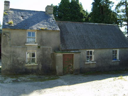 farm house1421 ydIndicatedEnclosure · 1459 ydEmbanked enclosureFairy fort / earthen ringfort · 1.5 mi
 Black Rock MountainMountain / peak · 1.5 mi
 Mount LeinsterMountain · 2.6 mi
 KnockroeMountain / peak · 2.7 miIrish Hangliding and Paragliding AssociationMemorial · 2.7 miSt Bridget's WellSpring · 3.2 mi
 Pedunculate Oak4.0 mi
 Common Lime5.2 mi
_-_geograph.org.uk_-_5029625.jpg/250px-Castles_of_Leinster,_Rathnageeragh,_Co._Carlow_(1)_-_geograph.org.uk_-_5029625.jpg "Photo: Mike Searle, Wikimedia Commons · CC BY-SA 2.0") Rathnageeragh Castle (in ruins)Castle, unclassified · 5.8 mi
Rathnageeragh Castle (in ruins)Castle, unclassified · 5.8 miMore archaeology and monuments in County Wexford · All of County Wexford
What do you know about this place?